
The Ma-le’l Dunes, sandwiched between the northwestern side of Humboldt Bay and the Pacific Ocean, have a fascinating history and are a great destination for hiking, birdwatching, and just enjoying the outdoors. They are among the few healthy dune systems left in California that did not have to make space for human developments, and one where habitat restoration efforts have been bringing back biodiversity to let plants and wildlife thrive. But that’s not even all: since a megaquake dropped the coastline and is believed to have set them in motion more than 300 years ago, they have been slowly swallowing a forest, a process we can actually observe on human timescales.
In this article, I’ll dive into that fascinating history, share with you what I discovered while visiting them and what I think is the best way to explore both the North and South Units of the dunes. Let’s dive in!
This post contains affiliate links. If you buy or book through them, I may earn a small kickback at no extra cost to you, which helps me write free resources like this one — thank you for supporting my blog.
Ancestral Lands of the Wiyot People
Ma-le'l is the name of one of several villages located on the North Spit of Humboldt Bay. When visiting the dunes, slough, marshes, forests, and beaches, you're walking through a sacred place to the Wiyot people, who have lived in this area since time immemorial. Their culture involved gathering berries, mollusks, and weaving materials, surf fishing, fish drying, and hunting waterfowl in the Ma-le'l Dunes area. Ma-le'l comes from the Wiyot word Moulu'l, which means "his house." Today, Wiyot people are actively involved in the protection of cultural resources and restoration of the landscape.
How a Megaquake Set the Stage for Sand Dunes Swallowing a Forest
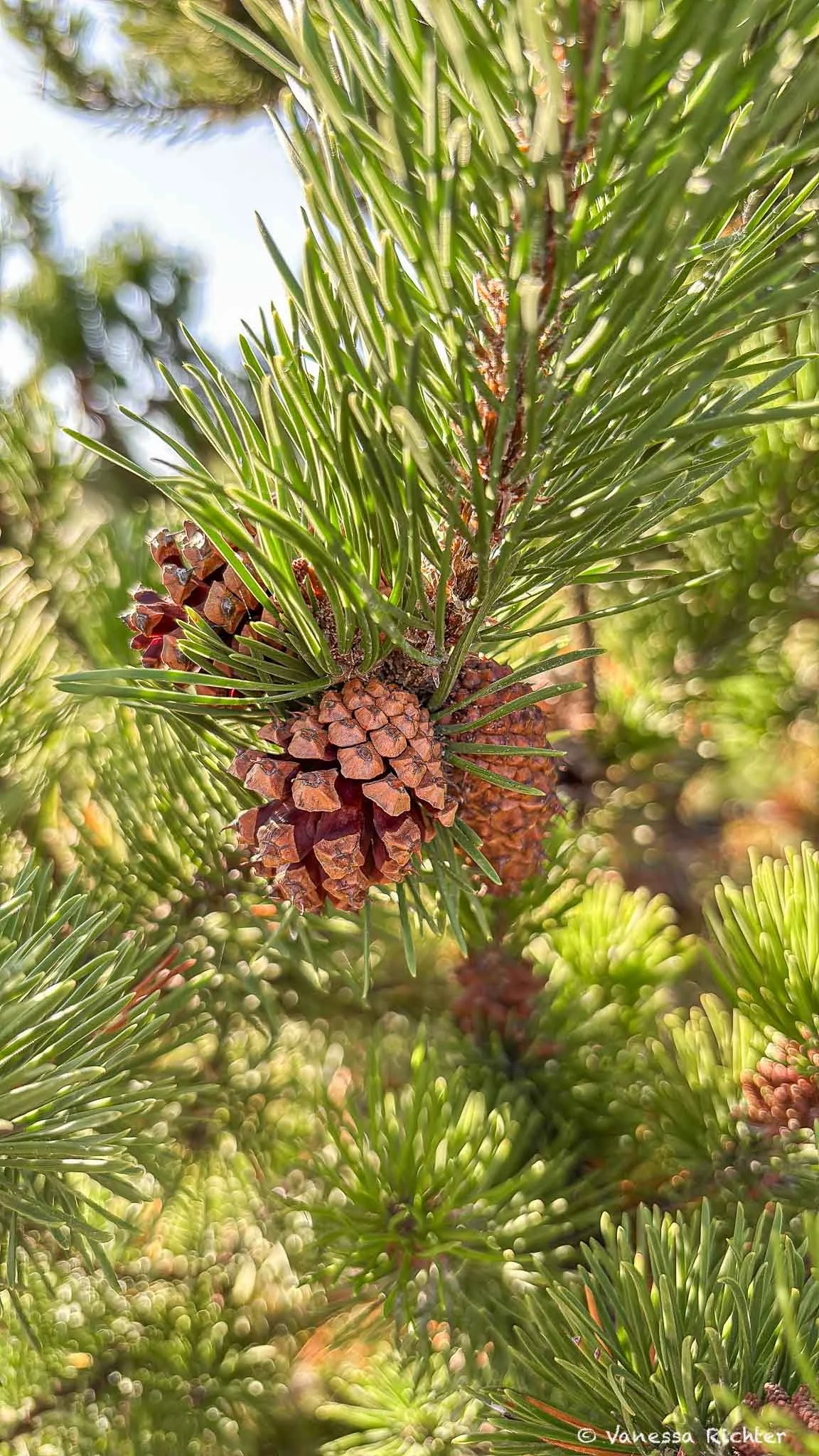
When I walked through the dunes for the first time, I was soon puzzled to find a bunch of pine trees in the midst of the dunefield. I pulled out iNaturalist to figure out what kind of pine they were, and the app showed lodgepole pine as the closest match. Thinking that this must be off, and even more confused than before, I put the phone away. Lodgepole pines are usually at home in mountainous areas, in California primarily in the Sierra Nevada, so I was absolutely not associating them with the coast and for sure not with sand dunes. On top of that, besides their cones and needles, they did not even look like the lodgepole pine I knew, a tree that can grow up to 112 feet tall. What I was seeing looked more like a really dense shrub than an upright tree with a large trunk. Later, I learned that iNaturalist was not so wrong after all. The app did give the right hint. What I had been looking at was in fact a coastal subspecies of the lodgepole pine, a so-called beach pine. The question remained: what were these trees doing in the midst of sand dunes?
To get to the bottom of this question, we have to go back in time more than 300 years. The forest grows on older, stabilized dunes. The dune system itself has probably been in place for about 7,000 years, but the dunes now burying that forest are believed to date back only to the early 1700s.
When it comes to earthquakes along the California coast, the 1906 earthquake and the resulting fires that destroyed large parts of San Francisco are well known. Lesser known is an even more powerful quake that caused a devastating tsunami and dropped parts of the coastline in a flash, farther north. This megaquake, with an estimated magnitude of 8.7–9.2, happened on January 26, 1700, along the Cascadia Subduction Zone, which stretches all the way from Vancouver Island in Canada to Cape Mendocino in Northern California. At northern Humboldt Bay, the land sank about 2.8 feet (0.85 ± 0.46 meters).
The U.S. Fish and Wildlife Service says the large expanses of moving dunes at Lanphere and Ma-le’l are believed to have been set in motion by that same earthquake. Using stratigraphy, the study of layered sediments, geologists who examined the North Spit dunes found that a tree killed by the youngest dune advance was first buried by sand between 1730 and 1750. The dunes likely advanced for many years before reaching it, and the researchers concluded that the advance likely began shortly after the 1700 earthquake. Since then, the sand has kept moving east, reaching the Mad River Slough in 2024. Along its leading edge, moving sand can bury even a mature forest, slowly swallowing the trees, while elsewhere the forest gradually advances onto dunes that plants have stabilized. Inside the dunefield, the picture is more mixed. Beach pine is often the first conifer to establish on a newly stabilized dune, where young pines form a dense thicket among shrubs until they outgrow them. The National Park Service also describes short, salt-pruned beach pines in the damp hollows between dunes. So the bushy pines I came across could be the last survivors of a forest the sand is swallowing, or the first pioneers of a new one.
Ma-le'l Dunes North
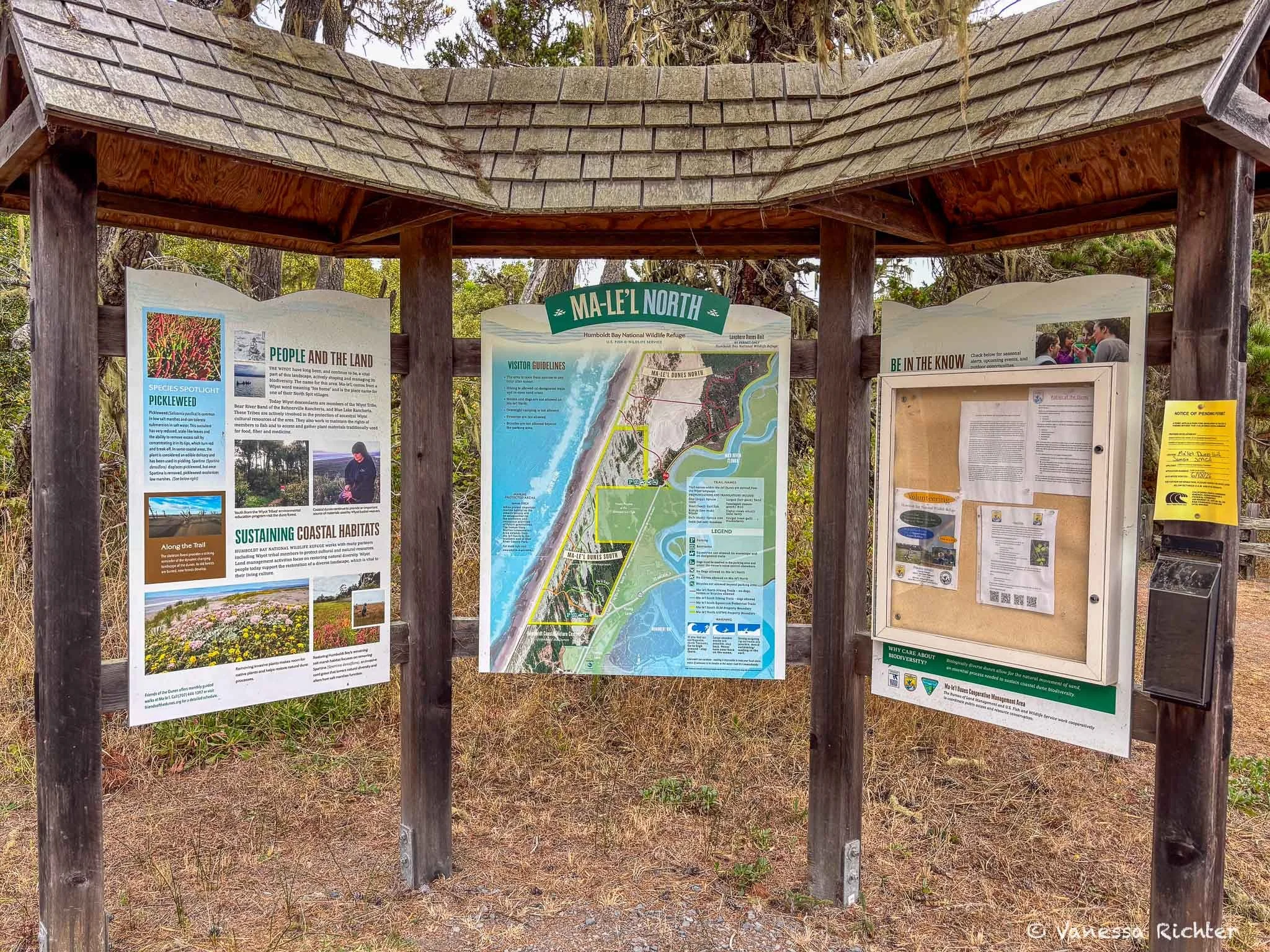
Ma-le'l Dunes North Unit · Humboldt Bay National Wildlife Refuge · California
Kimuk and Hout Loop
View on AllTrails →Scan for map & details
1.9 mi
3.1 km
Distance
88 ft
27 m
Elevation
Loop
Route
When we visited the North Unit of the dunes on a Saturday, we found the parking lot empty and not a soul on the trail. It was drizzling a little, but I was still surprised that absolutely no other person had decided to visit that day.
From the parking lot, you will start on the Tsoutsgish (tsoots-geesh; bird) Trail, which runs along the edge of the forest beside Humboldt Bay, where you can watch birds in the marshes on one side and look into the forest and the dunes on the other. From the Tsoutsgish Trail there are several paths leading up to the ocean: the Kimuk (kee-muk; whale) Trail, shortly after the trailhead, will quickly lead out of the forest. I recommend skipping this one for now to see something fascinating first: how the dunes have in one place already swallowed the forest right into the bay. You will see trees knocked over by the sand and lying in the water, with others still holding on for now. There is also a photo station where you can help monitor the site and the progression of the dunes by taking a photo and uploading it using the provided QR code.
From the Tsoutsgish Trail, the Dap (dopp; spruce) Loop leads deeper into the forest. At the far end of the loop, the Hout (hoot; surf fish) Trail branches off where sand dunes and forest meet and crosses the dunefield to the ocean. Otherwise, you can finish the Dap Loop for a short walk back to the Tsoutsgish Trail. A third option is to take the out-and-back Viqhul (veek-whull; salal berry) Trail to the edge of the Mad River Slough.
My tip: I recommend hiking the loop counterclockwise, starting on the Tsoutsgish Trail to see the marsh and the dunes meeting the forest first. Then head up the Dap Loop and the Hout Trail to the ocean, walk along the beach to the Kimuk Trail, and return to the parking lot. It works in either direction, and I highly recommend bringing binoculars to watch the birds in the marsh.
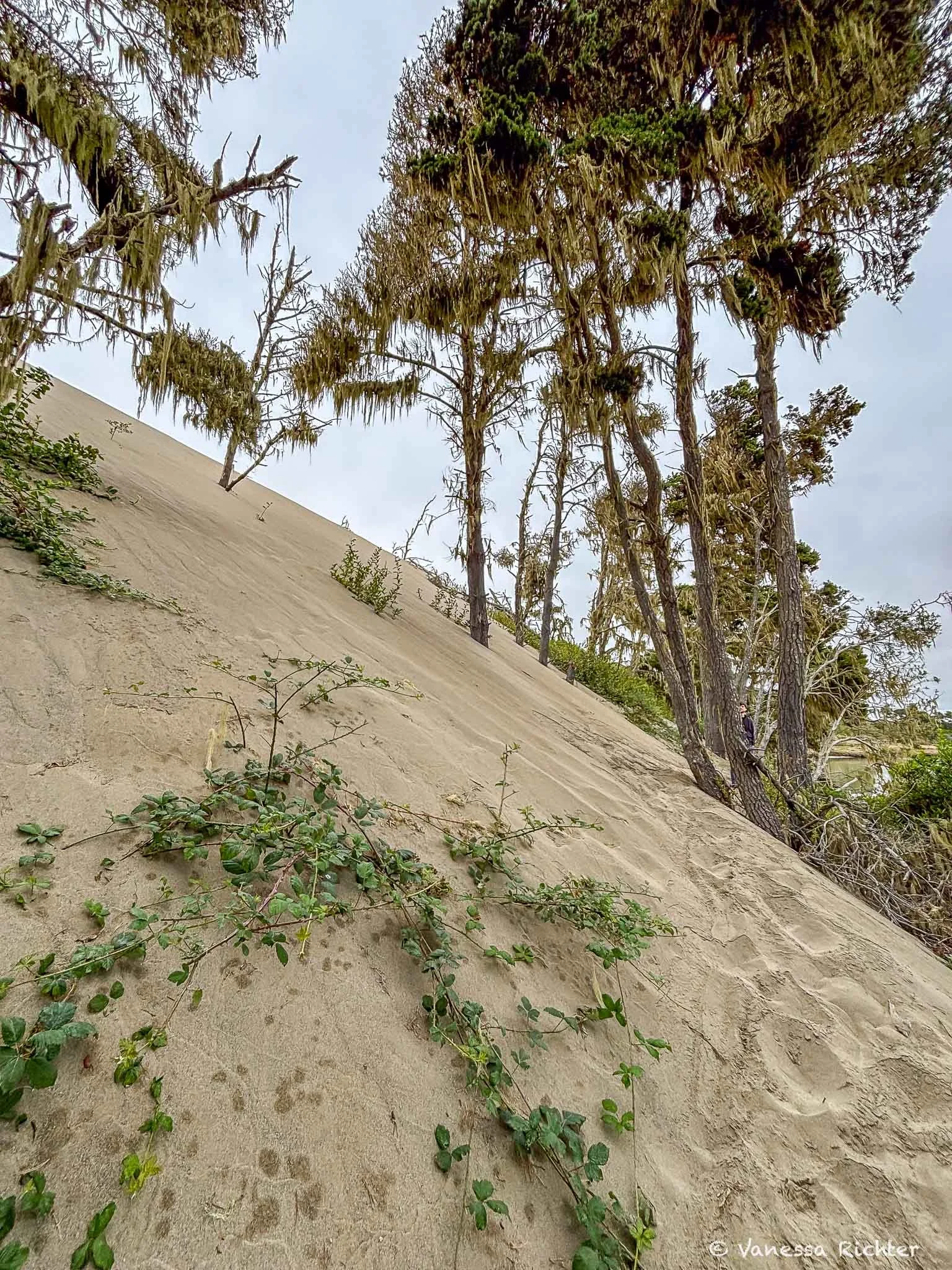
From the Tsoutsgish Trail, you can see pines clinging to the crest of a migrating dune (view to the left of the trail).
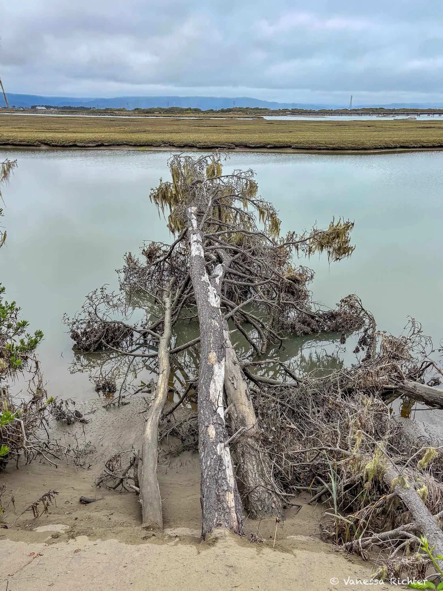
View to the right side: Knocked over by advancing sand dunes in marshy ground, these dead trees now lie in tidal water at the edge of the Ma-le'l Dunes.
Ma-le'l Dunes South
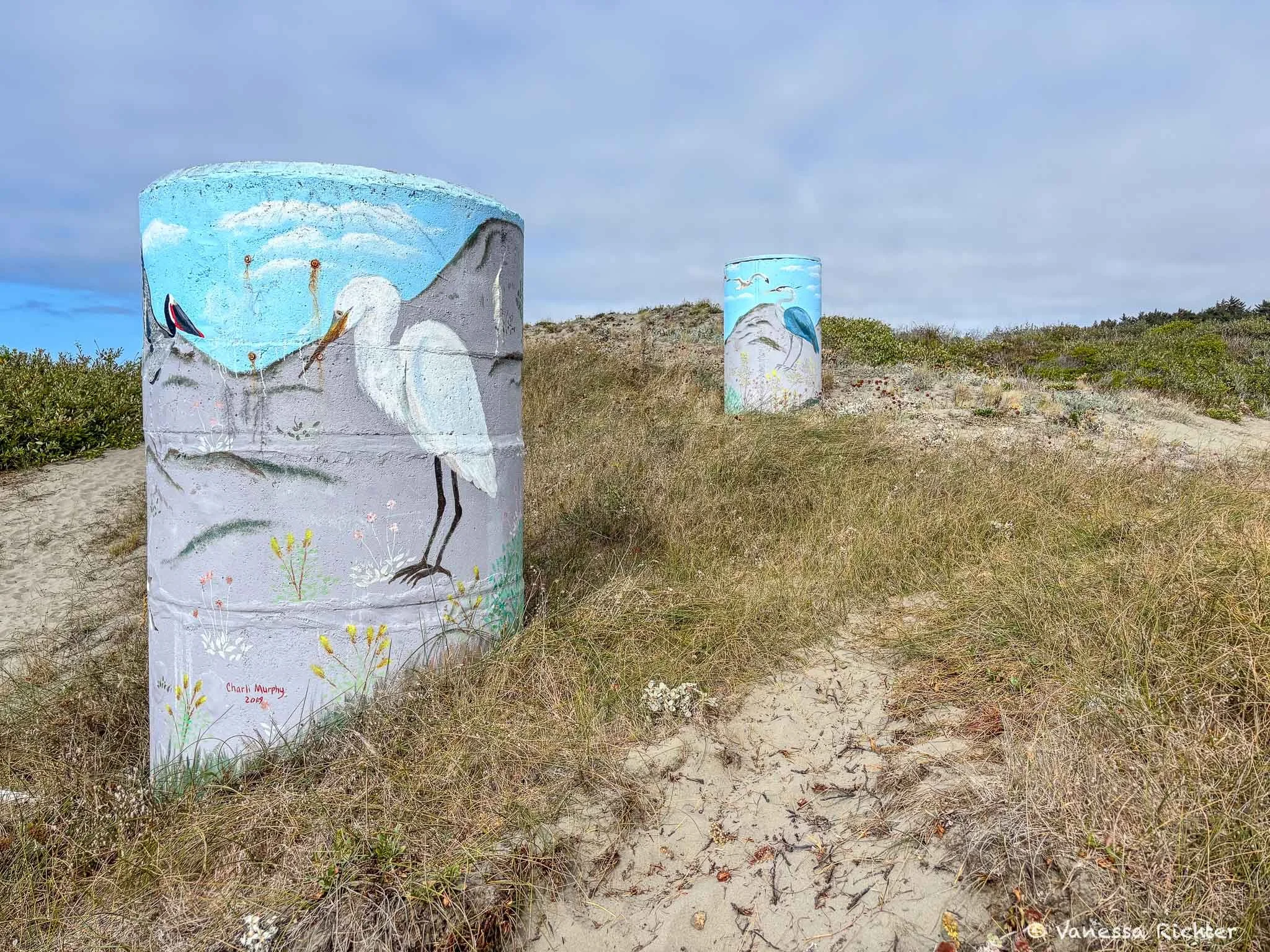
As you enter the southern dunefield, you are greeted by coastal art that is dressing these chimney-like leftovers from a past-era into a more appealing look. Unfortunately, I could not find what they originally were. Drop me a message or leave a comment if you know or have a guess. I’d appreciate any hint!
Ma-le'l Dunes South Unit · Bureau of Land Management · California
Ledik and Lutguk Loop
View on AllTrails →Scan for map & details
2.8 mi
4.5 km
Distance
52 ft
16 m
Elevation gain
Loop
Route
In the South Unit, we decided to hike the Ledik and Lutguk Loop, which leads you through the dunes to and along the ocean and back into the dunefield. We were amazed by the many shorebirds and shells along the beach while taking in the wide-open views of the shoreline. You could continue walking along the beach for miles and miles. In the dunefield, there were so many plants to see, including yellow sand verbena (Abronia latifolia), which was still blooming in its vibrant color in mid-September. We also noticed lots of coast buckwheat (Eriogonum latifolium), already past bloom but nevertheless beautiful to look at with its chocolate-brown seed heads. Both plants belong to the dune mat, the low-growing community of native wildflowers that grows in the partly stabilized dunes behind the foredune. As you get farther away from the ocean, you will also come across the shrubby beach pines in the dunefield, the ones that confused me and sent me digging into the research on this fascinating landscape!
My tip: We did this trail in the opposite direction from the one suggested on AllTrails. This way, you’ll reach the ocean sooner and head north, which I find more pleasant, especially at midday, with the sun at your back. As in the North Unit, it’s worth bringing binoculars to watch birds and other wildlife.
Habitat Restoration Across the Ma-le'l Dunes
Dune habitat restoration is happening across the Ma-le'l Dunes, in both the North and South Units, and it is part of why the dunes look the way they do today. Land managers across the dunes have been removing invasive European beachgrass (Ammophila arenaria), which had formed large monocultures and overstabilized the dunes. At the refuge-managed North Unit, this was done by hand from 2005 to 2010, and native American dunegrass (Leymus mollis) was planted in its place. The Bureau of Land Management, which manages the South Unit, has also restored parts of it, working with partners such as the nonprofit Friends of the Dunes.
The benefit is not specific to that one grass: locally native plants in general tend to support more biodiversity than introduced species. In this case, the beachgrass is native to the coasts of Europe and North Africa and was planted on the North Spit of Humboldt Bay in 1901 to stabilize sand along a railroad. It spread over the following decades and crowded out many native plants. With the dense beachgrass gone, the less dense native dunegrass and other native plants can recover.
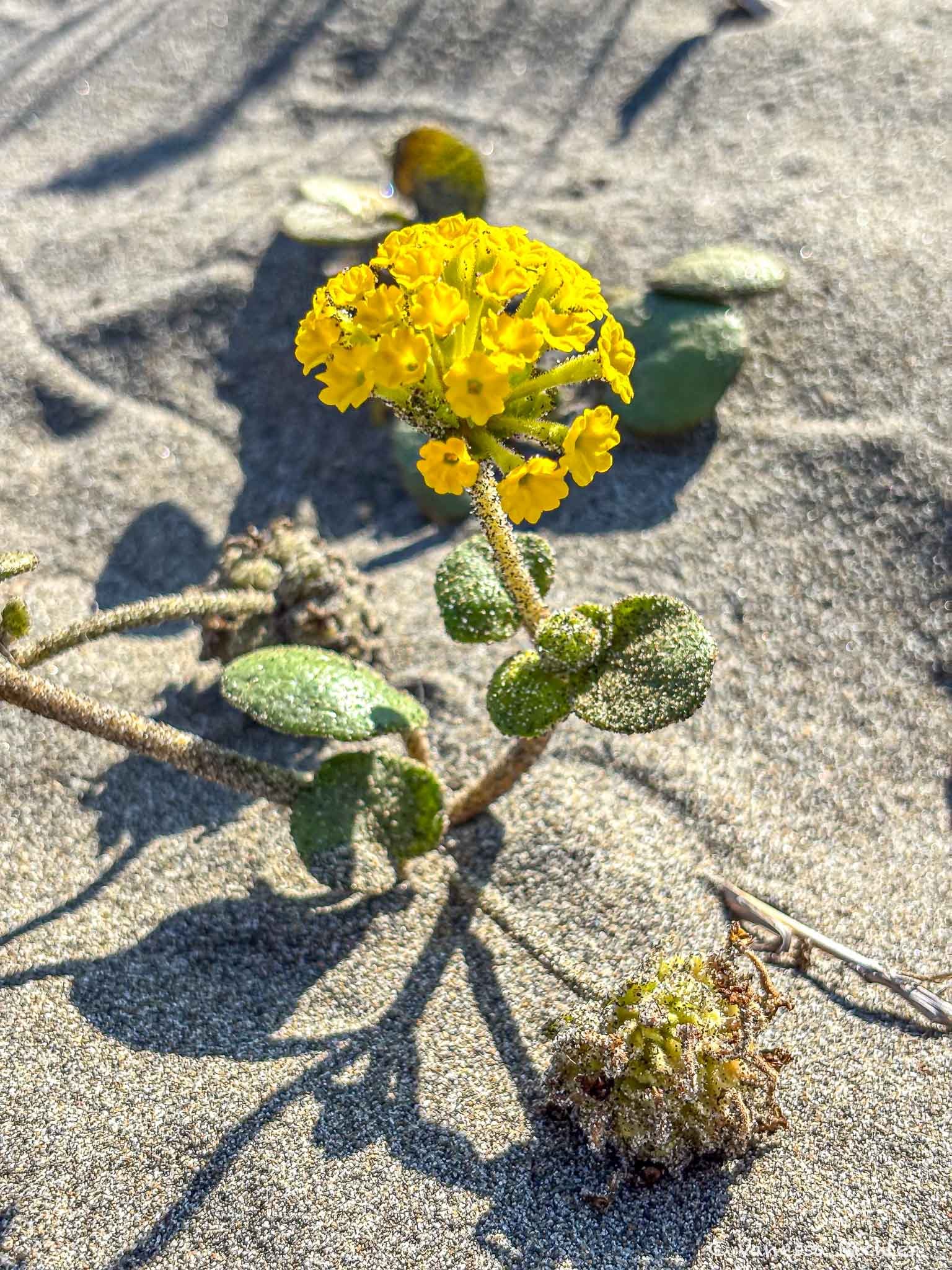
Look at this gorgeous vibrant yellow sand verbena that I found blooming at the Ma-le'l Dunes in September.
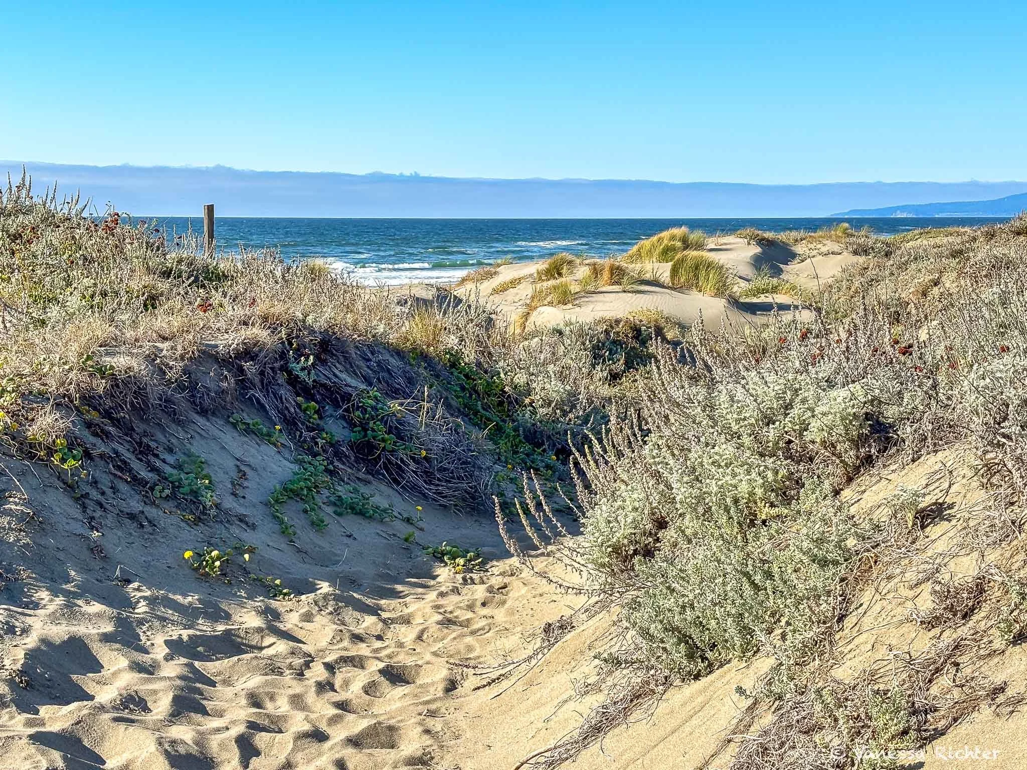
As you walk through the dunes, you will see a variety of dune species, thanks to habitat restoration efforts.
Know Before You Go
Parking & Access
- There are two lots: one for the North Unit and one for the South Unit.
- The road to the North Unit parking lot is closed to vehicles Tuesday, Wednesday, and Thursday. On these days, you can still park at the South Unit lot and walk or bike to the North Unit.
- Dogs and horses are allowed on designated trails in the South Unit only.
- Note that there is a shooting range next to the road to the North Unit, so you may hear shooting while visiting.
What to Bring
- I highly recommend dressing in layers. The coast around Humboldt Bay is often chilly and foggy (including in summer).
Optional extras that make the experience better:
- Binoculars. The dunes are a great place for birdwatching, with many shorebirds along the beach, songbirds and woodpeckers along the Tsoutsgish Trail, and birds in the marsh.
- Ultra-lightweight and compact: a small pair that is easy to carry all day often goes a long way for me. Compact pairs gather less light than full-size ones, so they work best in bright daylight. My go-to compact binoculars (paid link)
- For more detail and brightness: a larger, full-size pair gives you a clearer view, especially in low light. Here's my full-size pair that I love (paid link)
- Barefoot shoes. I find them perfect for hiking in sand, because you feel the soft ground much better than in regular shoes. Here is the pair I have and recommend (paid link)
- iNaturalist (free). If you spot something you can't identify, upload a photo: the app's AI takes a first guess, and then the community confirms or corrects it. And even if you do know what species you're looking at, your uploads contribute to citizen science. I use iNaturalist on pretty much every hike and generally when I am out and about.
- Merlin Bird ID (free). Made by the Cornell Lab of Ornithology, Merlin can identify birds just by listening to their song in real time.
Learn More About the Dunes
- I found a great video on YouTube (which has gotten far too few views so far in my view). We watched it after our first visit and then went back the next day, and it made exploring so much more interesting, since we knew a little better what we were looking at.

Support
- You can join Friends of the Dunes' Dune Ecosystem Restoration Team (DERT) in their habitat restoration mission. Check out when they meet on their website, where you can also learn about the dunes and the organization itself.
Read On


Follow the Adventure
Latest on the Blog

Looking For Something?

The Northern California coast is where the state shows its wildest side. Winding roads along rugged Pacific views, damp fern-covered forests, redwoods more than a thousand years old — acres upon acres of nature with the occasional small town in between. A road trip up this coast feels like stepping back in time. Here are 9 of my favorite places, with the best hikes, where to stay, and what to know before you go.