
Devils Garden Trail in Arches National Park: My Experience Hiking a Landscape Not as Permanent as It Seems
This post contains affiliate links. If you book through them, I may earn a small kickback at no extra cost to you, which helps me write free resources like this one — thank you for supporting my blog.
The Devils Garden Trail in Arches National Park is among the most popular day hikes, and for good reason: it leads you to the well-known Landscape Arch and many more lesser-known arches, along a trail that will also impress you with other rock formations and views reaching beyond the desert landscape to the snow-capped La Sal Mountains in the distance (at least if you visit in spring, when the peaks still tend to hold snow). In this article, I take you along this not always so straightforward, yet all the more rewarding trail, and share what I learned along the way.
Scan for map & details
8.1 mi
13.0 km
Distance
1,154 ft
352 m
Elevation
Loop
Route
Part I: The Arch That Could Collapse Any Second
The damp, sagebrush-scented desert air hit me in the best possible way as I opened the car door and stepped into the parking lot. I generously applied sunscreen to my face and legs and zipped up the hoodie I would need for at least the next hour. Arches National Park is a busy place, but it was still early in the morning, so just a few people were starting out on their hikes.
With the sand gently crunching beneath our shoes, we soon reached the first arches that were in close proximity to each other: Tunnel Arch and Pine Tree Arch, the latter appearing like a picture window for the landscape behind it. Overall, there are eight named arches to discover on this hike, and certainly many more unnamed ones. Arches National Park may be among the smaller national parks, but it is densely packed with what it is named for. Documented is an astonishing number of over 2,000 arches within the park boundaries. Staring into the window that the arch created, I tried to imagine what this window would have shown me long before human existence. While especially rocks and deserts can seem so immortal and stationary, incapable of change, Arches may be one of the places that remind us that nothing is permanent, even though some things may seem that way to us because they're so far beyond human timescales. That very arch window I was looking into would in fact not have existed yet. If I were to stand on that very point 65 million years ago, I would have been buried in a dry seabed under the Earth before geologic forces started shaping the landscape we see today. Uplift cracked the buried rock first, and erosion has been carving it ever since. Water does most of that work, as counterintuitive as it may seem in the desert, and it will one day erode the arches to the point that they collapse, one after the other. Nothing as dramatic as it sounds when we take into account the timescale on which this will happen, but still a reminder that permanence is an illusion. We might see an arch collapse here and there, but the park will remain famous for its arches in our lifetime.
Our next destination was one of those arches that could actually disappear in the not-so-distant future: Landscape Arch. As the longest natural arch in North America, stretching an incredible 306 feet (93.3 m), it is among the most famous arches in the park. While it is long, it is only 6 feet (1.8 meters) in diameter at its narrowest point. This fragile structure means it could collapse at any time. In fact, several large slabs of rock fell from the arch in the 1990s, prompting the closure of the trail beneath it for safety reasons.
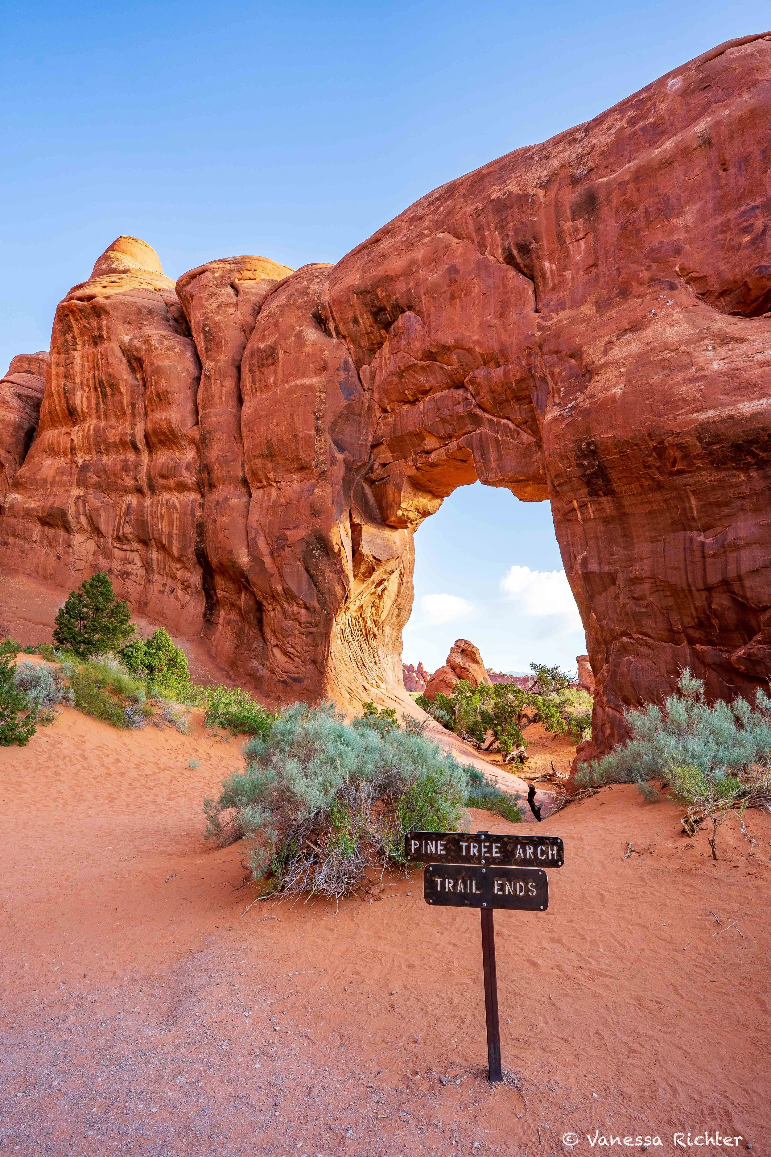
Pine Tree Arch
Pine Tree Arch and Tunnel Arch are the first two arches on this hike and are a quick, worthwhile detour from the main trail.
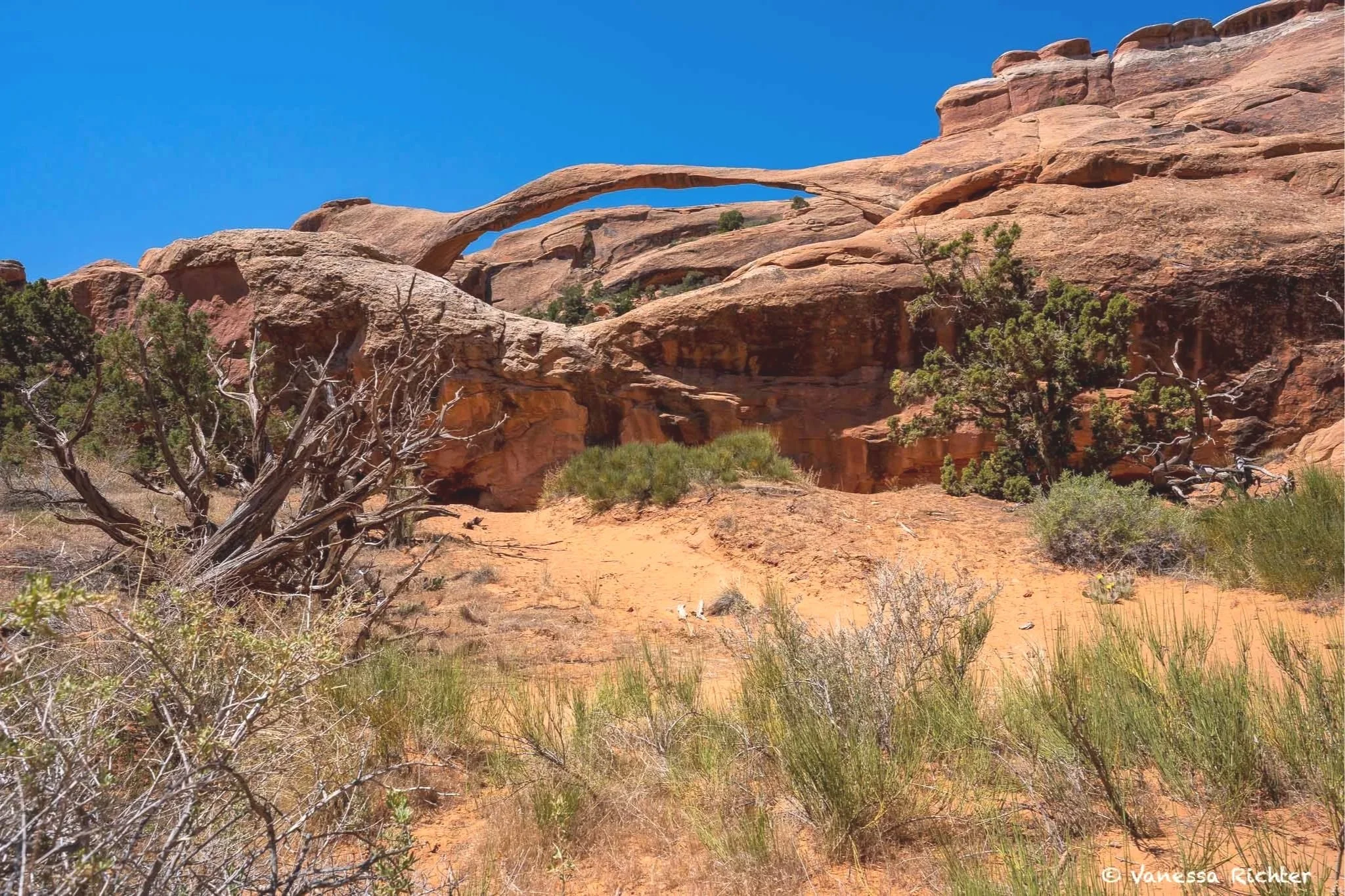
View of Landscape Arch from the trail. Before the 1991 rockfall, people could also hike beneath the arch, but that has been history since.
Part II: The Primitive Trail
As we hiked beyond Landscape Arch, we soon entered what is called the Primitive Trail section. A sign warned that the trail ahead would require scrambling and climbing on uneven surfaces and near cliff edges and is not recommended when wet or icy. While the area had already started to get a little busy around Landscape Arch, as soon as we left this part behind, the trail was, for now, devoid of people. With a thick layer of reddish sand beneath our feet dampening all the sounds around us, surprisingly lush bunchgrass to the side, and a view of odd rock shapes ahead of us, we enjoyed the landscape growing even more spectacular while the trail increased in difficulty.
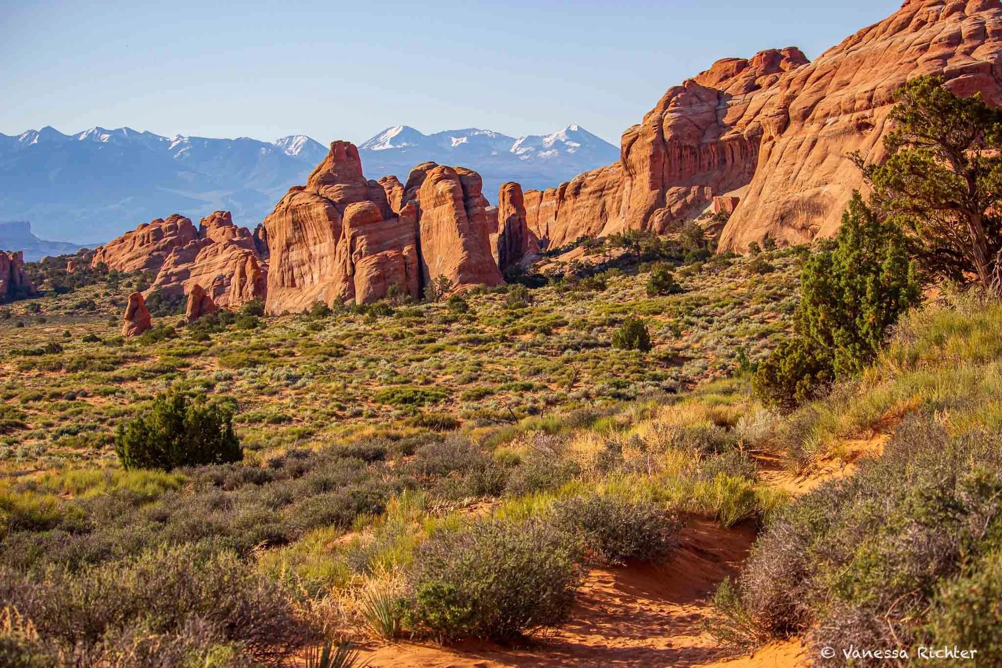
As we walked toward the cliff edges, we soon found ourselves in the midst of the slick walls, on polished ground instead of grippy sand. When the trail got narrower and narrower and suddenly ended, leaving only a steep wall in front of us, we realized that we had hit a dead end. I fumbled for my phone to pull up the trail navigation, glad I had downloaded the offline map before heading out. Along with some other hikers, we realized that what looked like an "obvious" trail wasn't a trail at all, just a smooth stone path with a dead end carved into the canyon wall. We backtracked a bit, and finally found where we had wandered off the actual path, which looked more like a large piece of slickrock that we needed to scramble up. Once we had scrambled up the rock, the trail became more apparent again. In the midst of these rock walls, it was fascinating to see mature trees grow out of the cracks where water collects after storms, thriving in this harsh desert environment. As we got further up, the views got better and better, reaching further, laying out all the rugged rocks before us with their unique shapes and layers of different deposits that collected over millions of years. While we were in fact walking on a ridge with a steep drop to either side in the midst of this rock wonderland, it was wide enough to feel safe to us (I am probably average when it comes to fear of heights). As we explored Private Arch, another one of the many arches on this trail, we suddenly heard crunching and rustling sounds behind us. A squirrel was feasting in the pinyon pine tree behind us, gripping the twigs tightly with its tiny hands to access the cones. Once it finally got one, it held it firmly and started to feed on the thing that was half as big as its head. I could have watched for hours!
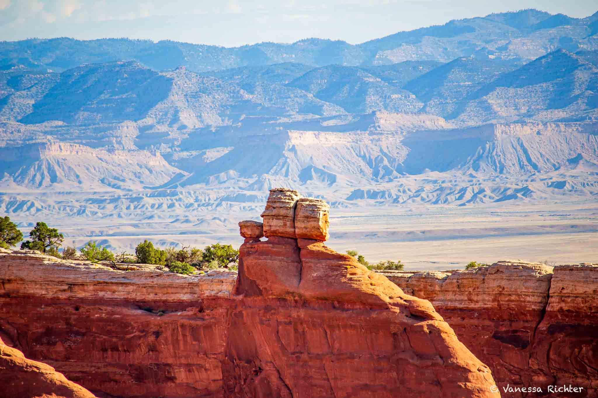
The human brain has a tendency to find faces in almost everything — I can definitely see three in this picture. Is it just me?
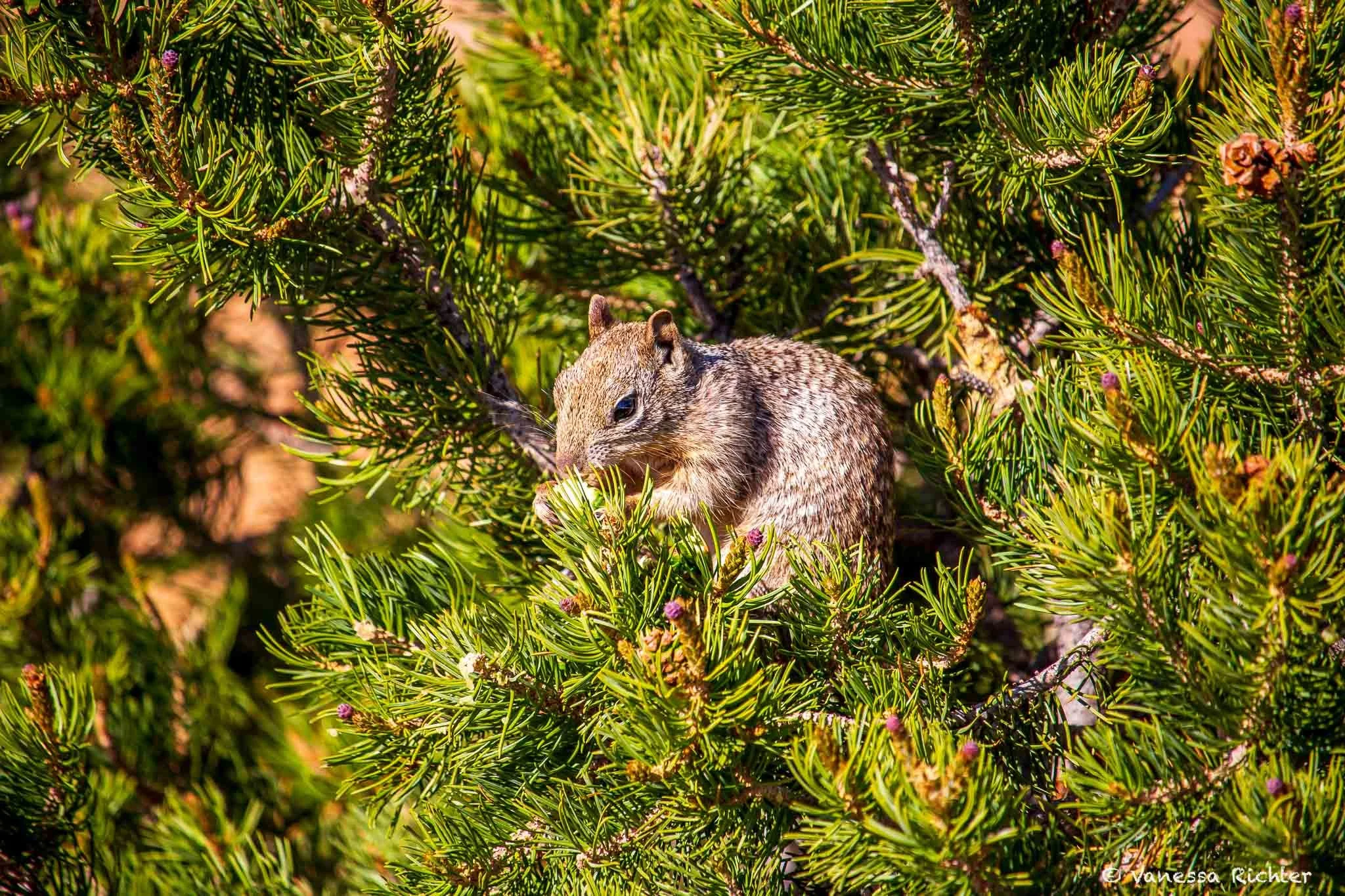
Spotted in a tree near Private Arch: This cutie was feasting on the pine cones.

On the trail, we spotted a long-nosed leopard lizard (Gambelia wislizenii) resting on sun-warmed sandstone. Despite the name, it's the tail that steals the show, often longer than the rest of its body combined. Also, look at those toes!
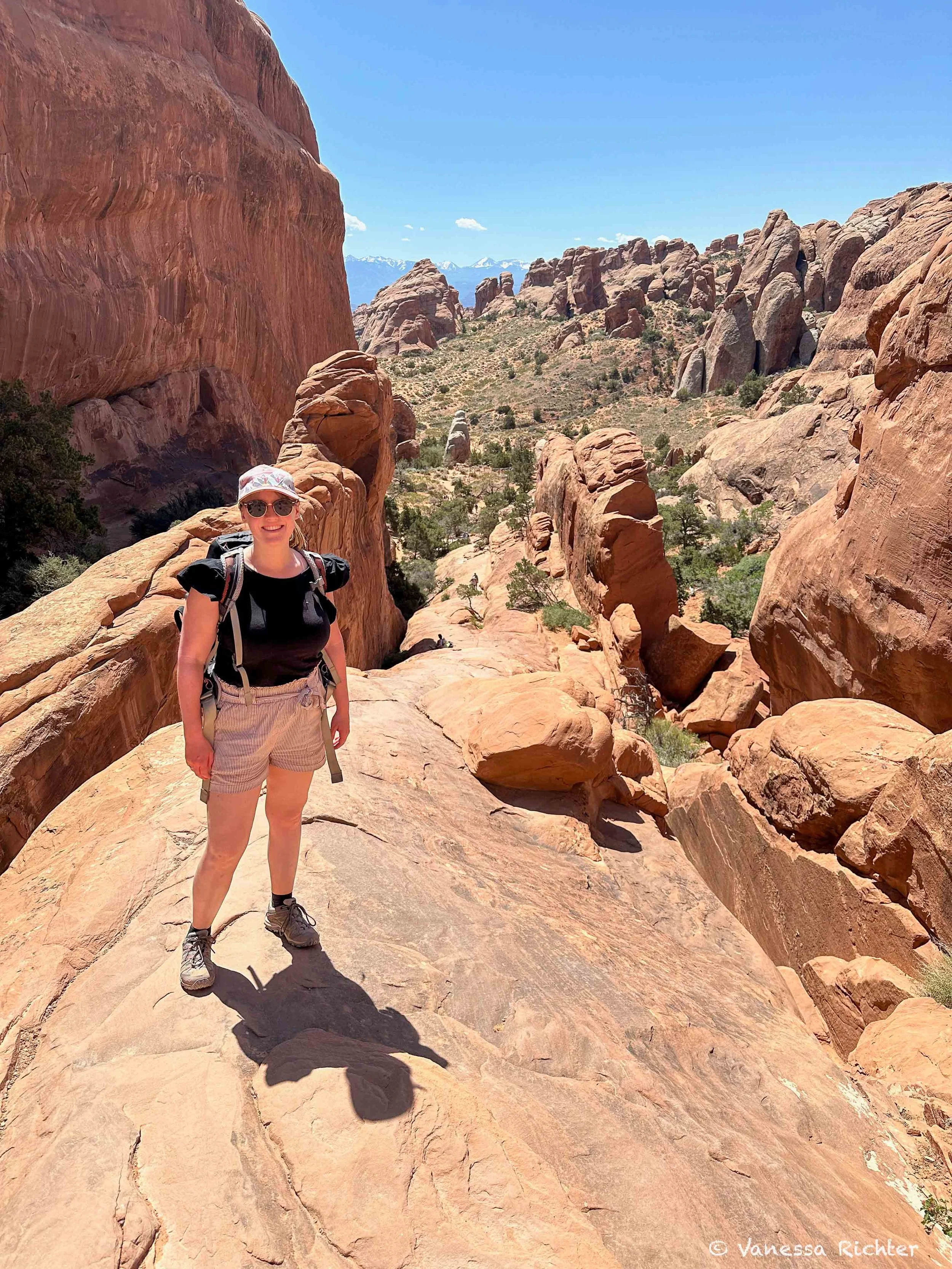
As we continued hiking along sandstone ridges, there were, surprise, even more arches to explore before the trail eventually got busy again as we closed the loop back to the trailhead, and we got another, closer look at Landscape Arch.
I can't tell you which one my favorite arch was: they're each unique, both in themselves and in how they sit within the landscape, and they are certainly one reason to do this hike. But just as much, if not more, I think this trail is worth doing because the scenery beyond just the arches is absolutely stunning: the views when the landscape opens up, or when you're hiking on a rocky ridge with snow-capped mountains in the distance. And it's always the little surprises on the way that make each hike on the same trail unique: the small flower you'll discover on the side of the trail, the lizard you've never seen before that crosses your path, or the squirrel happily munching on cones. There's always more to see than you expect or plan for.
Know Before You Go
Access
- Arches has a fee to enter; see the NPS passes and fees page for current pricing, including annual pass options for US and international visitors. No timed entry reservations are required in 2026.
- The trailhead is located at the very end of the park road, about a 45-minute drive from the visitor center.
- Parking lots can be very busy during spring and fall peak season and during holiday weekends, so I recommend arriving early.
What to Expect
- The Devils Garden Trail* is an excellent choice for exploring a bit deeper into Arches National Park. The first part of the trail leads to the iconic Landscape Arch, one of the park's most famous formations, so this section can be very busy.
- Beyond Landscape Arch, the trail continues to more breathtaking arch formations and incredible views. The further you hike, the fewer people you'll encounter, but the more difficult the hike gets.
- In the second half of the hike, be prepared for some scrambling on slickrock and occasional exposure to heights. While it's nothing super extreme in my view, it does require caution and should be avoided entirely when the rock is wet or icy, or if you have a strong fear of heights and exposure.
- Bring a lot of water. There's no water source along the trail, and shade is limited.
- I also highly recommend downloading trail navigation* before heading out. We had some difficulty finding the trail at one point, and without navigation, continuing the hike would have been quite challenging, and we might have ended up turning back instead.
- This hike isn't for those seeking an easy walk (if that's what you're looking for, it's still worth hiking to Landscape Arch and turning around there), but if you're up for a pinch of adventure, you'll be rewarded with a stunning variety of uniquely shaped arches and rocks amid breathtaking views, with more solitude.
Where to Stay
- Devils Garden Campground inside the park is available by reservation from March through October, and first-come, first-served in the winter months.
- Moab is the closest town, with plenty of options, like this hotel* super close to the park, or if you'd like something all to yourself, there are plenty of options for renting an entire vacation home* in Moab and the surrounding area.
*Affiliate links.
Read On


Follow the Adventure
Latest on the Blog
Looking For Something?

What could be more breathtaking than a road trip from California’s rugged coast across Utah’s deep red deserts to Colorado’s rushing mountain rivers in late spring? Imagine yourself traversing the vast, sun-scorched deserts along the Loneliest Road in America, gazing into the universe under some of the world’s darkest skies, hiking the tallest sand dunes in the Northern Hemisphere, and admiring turquoise alpine lakes while looking down at bone-dry deserts stretching endlessly below. In this article, I’ll take you through my absolute favorite outdoor adventures on a road trip from California’s coast through Utah and Nevada’s wild landscapes to Colorado’s Rocky Mountains.