Guide to Mono Lake: Exploring Tufa Towers, a Home to Trillions, and the Fight for Its Water
This post contains affiliate links. If you book through them, I may earn a small kickback at no extra cost to you, which helps me write free resources like this one — thank you for supporting my blog.
On the eastern side of the Sierra Nevada, there's a lake where pale tufa towers rise from water saltier than the ocean, ringed by sagebrush and snowy mountain peaks.
Mono Lake is one of the oldest lakes in North America — likely more than 760,000 years old and possibly over a million years old. For all that time, Eastern Sierra streams have been pouring in, carrying salts and minerals down from the mountains. With no outlet for roughly the past 80,000 years, water can only leave through evaporation, and the salts stay behind. Thousands of years of this have produced very alkaline water, 2-3 times saltier than the ocean. Even though it has been called that, Mono is anything but a dead sea. A handful of species have evolved to thrive in exactly these conditions, and they do it in staggering numbers.
In this article, I'll share how to best explore this special lake, and all the details about its existence and the life it supports that make it so fascinating beyond its beauty.
A Lake Unlike Most Others
The closer you look at Mono Lake, the stranger it gets. The white crust along the shoreline, the pale towers rising from the water, the volcanic islands, the desert around it and the mountain peaks nearby. At first sight, none of it fits together, and yet it does perfectly if you travel back millions of years.
Built by Tectonics, Shaped by Glaciers
The basin Mono Lake sits in started forming millions of years ago, when tectonic forces began stretching and pulling apart the Earth's crust along the eastern edge of the Sierra Nevada. The crust didn't crack cleanly; it warped, flexed, and dropped in places, opening depressions that would eventually fill with water. Mono Basin is one of them. For the past approximately 80,000 years, Mono Lake has not had an outlet. This means, water flows in, evaporates, and leaves its dissolved minerals behind. Over time, those minerals accumulate, making the lake hypersaline and saltier than the ocean. However, it was not always like that. Mono Lake was called "Lake Russell" during wetter periods when it carried much more water, resulting in the lake pouring into outlet streams. Some of these periods stretch back up to 3 million years ago.
Around 11,000 to 12,000 years ago, at the peak of the last glaciation, the lake was five times its current size, covering 338 square miles and reaching a depth of 900 feet, fed by glaciers draping the Sierra Nevada to the west. When the climate warmed and the glaciers retreated, the lake shrank back over thousands of years to something closer to what you see today (it is still lower than it would naturally be, but more on that further below). The high-water marks of that ancient lake, the terraces carved into the hillsides and ancient beaches stranded far above the current shoreline, are still visible if you know to look for them.
Another factor that has been shaping the basin: volcanic activity. The Mono-Inyo Craters chain, a line of volcanic vents running south from the lake, has been erupting on and off for around 40,000 years, with the most recent eruption in the 17th century, pushing up the mass of lake sediments that became Paoha Island, the larger of the two islands in the lake. Panum Crater, on the south shore of the lake, is a combined rhyolite dome and cinder cone that formed around 600-700 years ago. Currently dormant, the Mono Crater will likely produce eruptions in the future, and is monitored by the California Volcano Observatory (CalVO) of the US Geological Survey.
Tufa Towers: The Lake's Exposed Secret
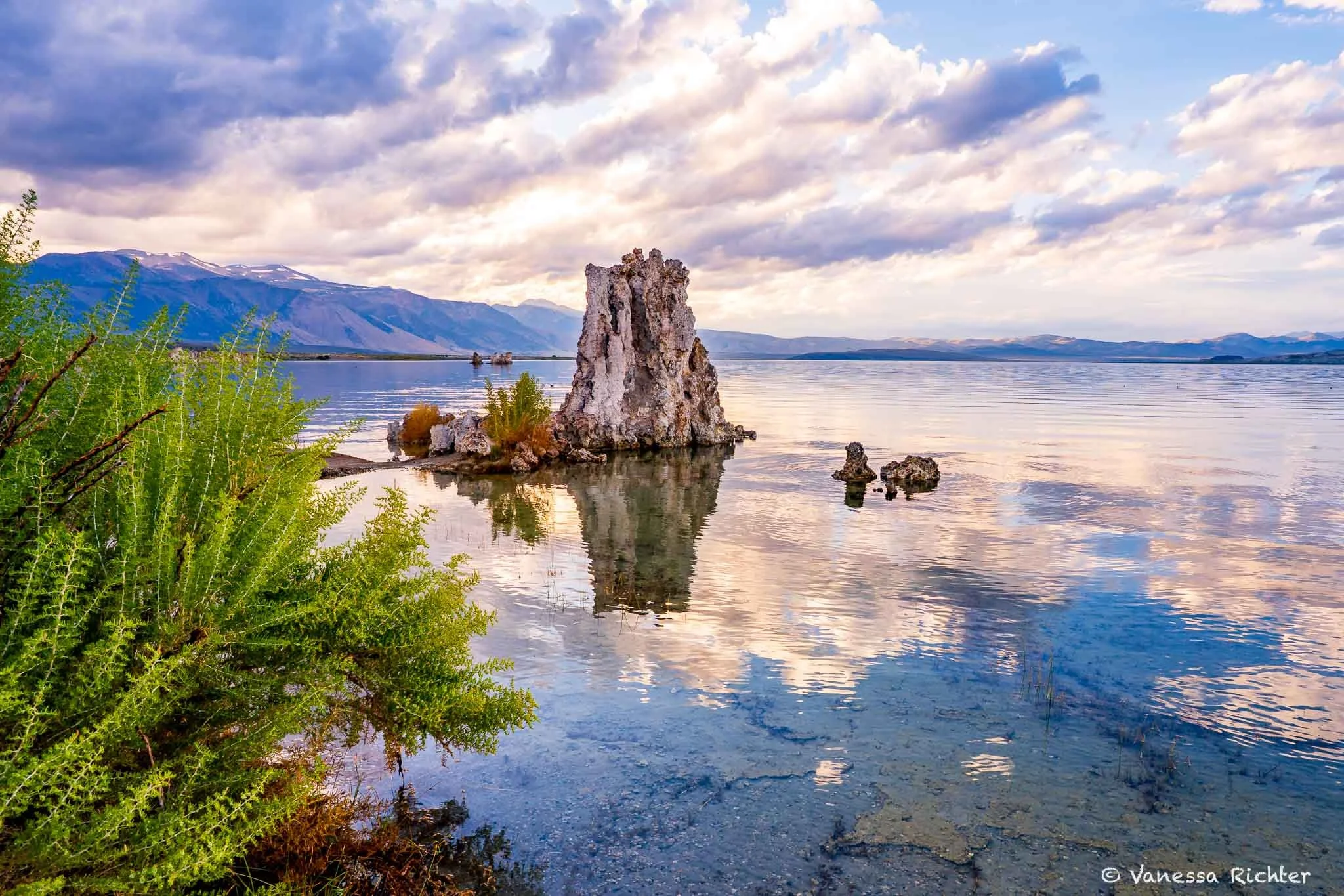
Many iconic rock formations — like the arches in the namesake national park, California's rocky coastline, or Bryce's hoodoos — are in some shape or form a result of erosion: the elements progressively working on the material, chipping off the less resilient bits and pieces one after the other. The tufa towers with their pale, rocky appearance are different. In fact, they grew, for the most part, exactly the way they are now. However, when you see them standing above the water today, you are actually looking at something frozen mid-growth.
💡 Tufa At A Glance
🫧 Tufa towers are limestone — made by chemistry, not erosion. The recipe: lake water (carbonates) + spring water (calcium) = tufa (calcium carbonate).
💧 They only grow underwater. The reaction needs the lake. Once a tower is exposed, it stops growing — frozen in whatever shape it had reached. Every tower you see standing in the open air is, in that sense, a fossil.
🕰️ How old? The towers at South Tufa are younger than ~300 years. But high above the current shoreline, on the lake's ancient beaches, you can still find tufa up to 13,000 years old.
Calcium-rich freshwater springs bubble up from the lakebed, meet the carbonate-rich lake water above, and the two react — precipitating solid calcium carbonate right there, around each spring's mouth. The same mineral as seashells. The towers don't get carved out of something. They build up, one layer at a time, from the inside out. And they only grow underwater. The moment a tower breaks the surface, the reaction stops, and whatever shape it had reached is the shape it keeps.
Which raises the obvious question: why are so many of them exposed, some of them quite high above the water surface?
The answer depends on which ones you're looking at. The towers found high above the current shoreline are the oldest — some more than 13,000 years old. They got there the slow, natural way: Mono Lake was once dramatically larger, fed by glaciers during the last Ice Age, and as the climate warmed and the glaciers retreated, the lake shrank over thousands of years, leaving those towers stranded on what are now ancient beaches. The ones at South Tufa are much younger, at around 300 years old, and their exposure is a different story entirely — one that involves Los Angeles. More on that below.
Exploring Mono Lake
South Tufa Trail
Mono Lake Tufa State Natural Reserve · Eastern Sierra · California
South Tufa Loop Trail
View on AllTrails →Scan for map & details
📏
0.8 mi
1.3 km
Distance
⛰
26 ft
8 m
Elevation
🔄
Loop
Route
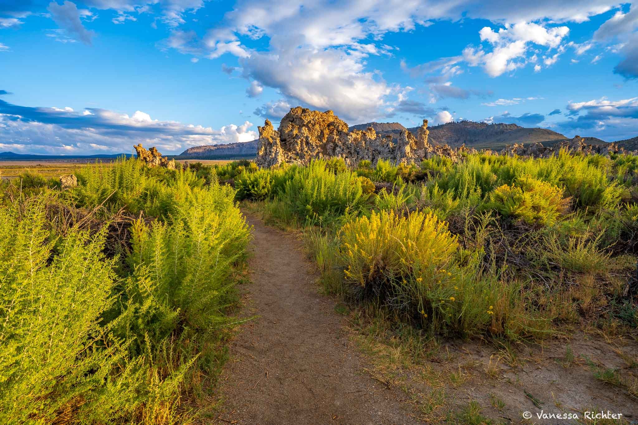
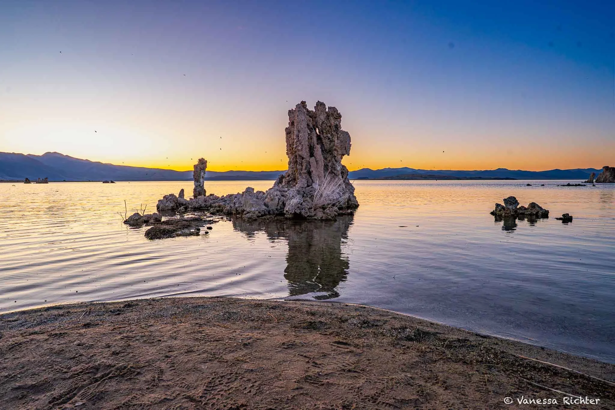
The South Tufa Interpretive Trail offers the best views of the tufa towers, with the Sierra Nevada as a backdrop to the west and a wide view over the lake. The trail is short and flat — an easy walk regardless of when you visit. It is an interpretive trail, so you'll find signs both at the parking lot and along the route itself.
At different times of day, you'll be rewarded with different things: soft light on a calm water surface in the morning, the tufa towers glowing bright white in the midday sun, an explosion of colors in the evening, or the lake mirroring the stars at night.
Sunset at South Tufa
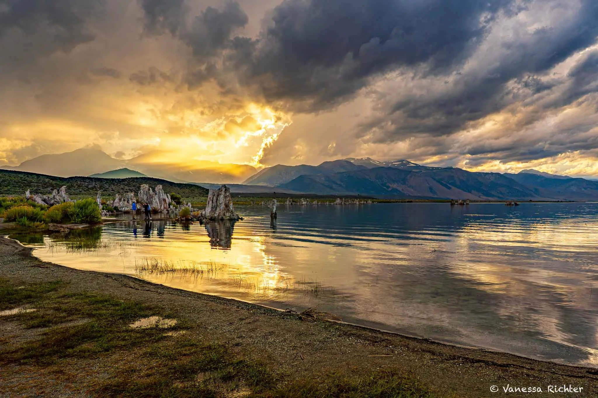
If you have to choose one time of day to visit the lake and you don’t feel like walking down to the lake in absolute darkness or hours before you’d usually get up, go at sunset. The sun will disappear right behind the jagged peaks of the Sierra Nevada — typically there are a few puffy clouds that will make the colorful show even more spectacular and let the last moments before dark really glow while Mono Lake acts as a mirror, reflecting the whole drama of reddish shades.
And if you get REALLY lucky with the conditions, the entire lake may turn pink to purple once the sun has disappeared over the mountain range. I’ve been to Mono Lake many times, but never got quite as lucky (but saw an awe-inspiring sunset anyway every time I went there).
Also, if you think the sunset is over, wait a few minutes, sometimes the show is in fact not over yet!
The David Gaines Memorial Boardwalk
Mono Lake Tufa State Natural Reserve · Eastern Sierra · California
Mono Lake Viewpoint Trail (Starting From Visitor Center)
View on AllTrails →Scan for map & details
📏
2.6 mi
4.2 km
Distance
⛰
321 ft
98 m
Elevation
↔️
Out & Back
Route
A quieter angle on the lake than South Tufa, and worth the stop. You can start from the visitor center and walk the trail down to the David Gaines Memorial Boardwalk, which runs along the lakeshore and gives you views of the water and the islands (linked above). Or, opt for the shorter version and park at the Old Marina parking lot directly off Highway 395, about a mile north of Lee Vining. From there it's a short, flat walk to the boardwalk.
The tufa here looks slightly different from South Tufa, and there's a reason. Many of the towers at Old Marina are pumice-block tufa — formed when large chunks of pumice from Negit Island's eruption floated across the lake and eventually settled on the shore, where the same calcium and carbonate reaction built up around them.
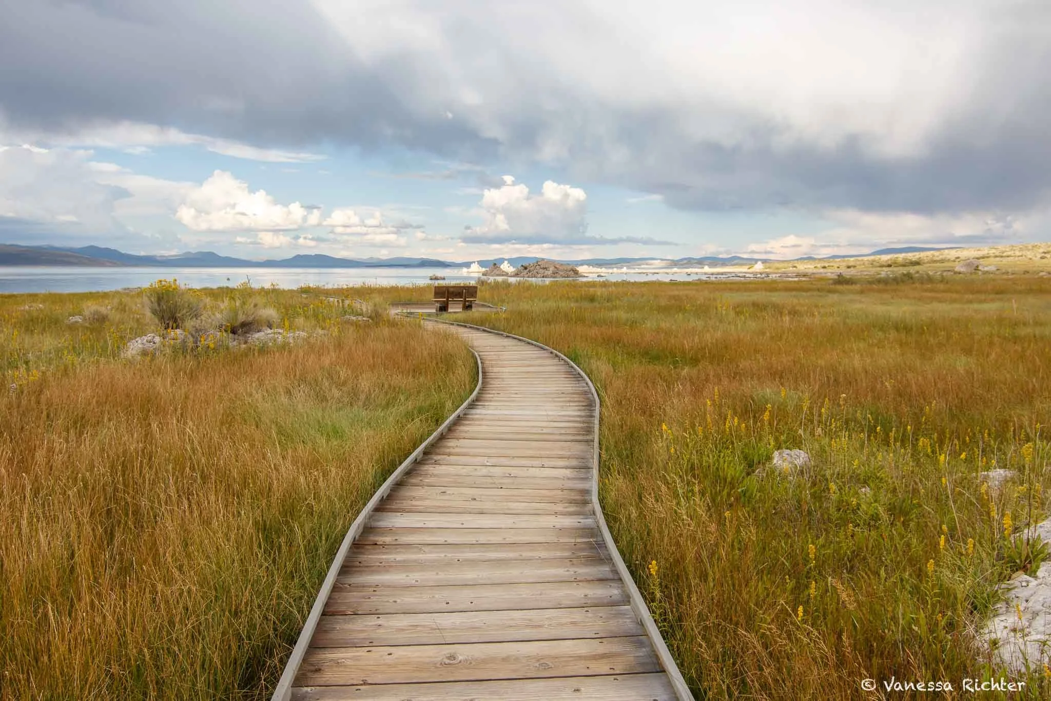
David Gaines Memorial Boardwalk on a partly cloudy afternoon.
Mono Lake County Park
The boardwalk through the Mono Lake Tufa State Natural Reserve below County Park was destroyed in the May 2025 Inn Fire and is currently closed. The County Park lawn and restrooms are open. Check the Mono Lake Committee website for current status before visiting.
Navy Beach: Kayaking & Boating
If you want to get on the water, Navy Beach on the south shore is the place to launch. The parking area sits close to the shoreline and the carry to the water is short, making it the most practical put-in for kayaks, canoes, and paddleboards. The lake's hypersaline water is remarkably buoyant — paddling on Mono Lake feels different from any other water.
A few things worth knowing before you go. Access to the islands is restricted between April 1 and August 1 to protect nesting California gulls, and you need to stay at least 200 yards from Osprey nesting sites on the offshore tufa towers between April 1 and September 1. The lake is also known for sudden high winds, particularly in the afternoon — it's worth starting early and staying close to shore if you're not familiar with how quickly conditions can change.
A Living Lake: Ecology & Conservation
Mono Lake looks like it shouldn't support much life. The water is too salty, too alkaline, and there are no fish. But looks are misleading. The lake supports two million migratory birds every year and runs on an ecosystem of extraordinary simplicity that makes it highly efficient at the same time. The chemistry that makes it inhospitable to most things is exactly what makes it so productive for everything adapted to it.
Brine Shrimp, Alkali Flies & the Birds They Feed
The food web in Mono Lake seems straightforward. Microscopic algae grow in the sunlit water. Brine shrimp and alkali flies eat the algae. Birds eat the shrimp and flies. No fish live here since the chemistry of the water prevents it. The visible food web is narrow: algae, two invertebrates, the birds that eat them. What's remarkable is the sheer scale of what those few species produce. The brine shrimp alone number trillions of individuals.
The alkali fly is its own kind of wonder. When a fly enters the lake, fine hairs on its body trap a layer of air like a personal diving bell. It walks down the submerged rocks and tufa, grazes on algae, lays its eggs, then pops back to the surface bone dry. To the Kutzadika'a Paiute, the Indigenous people of the Mono Basin, the fly pupae were a staple food and trade good. The name Kutzadika'a itself means "fly-pupae eaters," the lake's ecology written directly into the language of the people who lived with it for the longest.
Up to two million eared grebes stop at the lake in fall, a large share of North America's entire population, doubling or in some cases nearly tripling their body weight before continuing south. More than 100,000 phalaropes pass through as well. California gulls nest on the islands in the second largest colony in the world. Snowy plovers breed along the shore. Around 100 bird species use the lake at various points in the year. All of it runs on brine shrimp and alkali flies.
🦐 Creature Spotlight: Mono Lake Brine Shrimp (Artemia monica)
🧂 A species found nowhere else. Artemia monica lives only in Mono Lake. It evolved here, in water two to three times saltier than the ocean, with an alkaline pH of around 9.8 — conditions almost nothing else can survive.
🔢 Trillions, not millions. At peak summer, 4–12 trillion shrimp swim in the lake. They're only about half an inch long, but together they form extraordinary concentrations of animal life.
📅 Built around the seasons. Adults appear in spring, peak in summer, and die off as winter approaches — but not before laying eggs that overwinter in the lake-bottom mud and hatch as the water warms again.
🐦 The reason the birds come. Without these shrimp (and the alkali flies), there would be no California gull colony, no million-grebe spectacle, no phalaropes.
A Glimpse Into The Plants of The Basin
While the tufa formations are the stars of the lake, there's more to discover. Slow down on the paths around the lake and take a closer look at the grey-green hues around you.
Most of what you're walking through is big sagebrush, the dominant plant across most of the Great Basin. Its wedge-shaped leaves are covered in fine hairs that slow evaporation, a practical solution to a place that gets little rain and a lot of wind. On a moist morning or after a storm, breathe it in. I think there's nothing more calming and freeing than the smell of sagebrush.
Most commonly growing alongside the sagebrush at the lake are Caterpillar Greasewood whose flowers resemble caterpillars when in bloom and rubber rabbitbrush, which covers itself in bright yellow flowers in late summer. Both are pioneer species that came in as the lake level dropped, colonizing the newly exposed alkaline lakebed that most plants can't tolerate. The more of it you see, the more you're standing on what used to be underwater.
And then, from June through August, there's another flower that stands out: the prickly poppy. Unlike California's state flower, the California poppy, which looks mellow and cheerful at the same time, the prickly poppy has a much fiercer appearance with its spiky leaves and large flower heads that resemble sunny-side up eggs.
This is just a tiny slice of what the basin holds. If you want to go deeper, iNaturalist has a strong record of Mono Lake observations — the tools I use for observing more closely and identifying plants in the field are listed in the Naturalist's Kit further down.
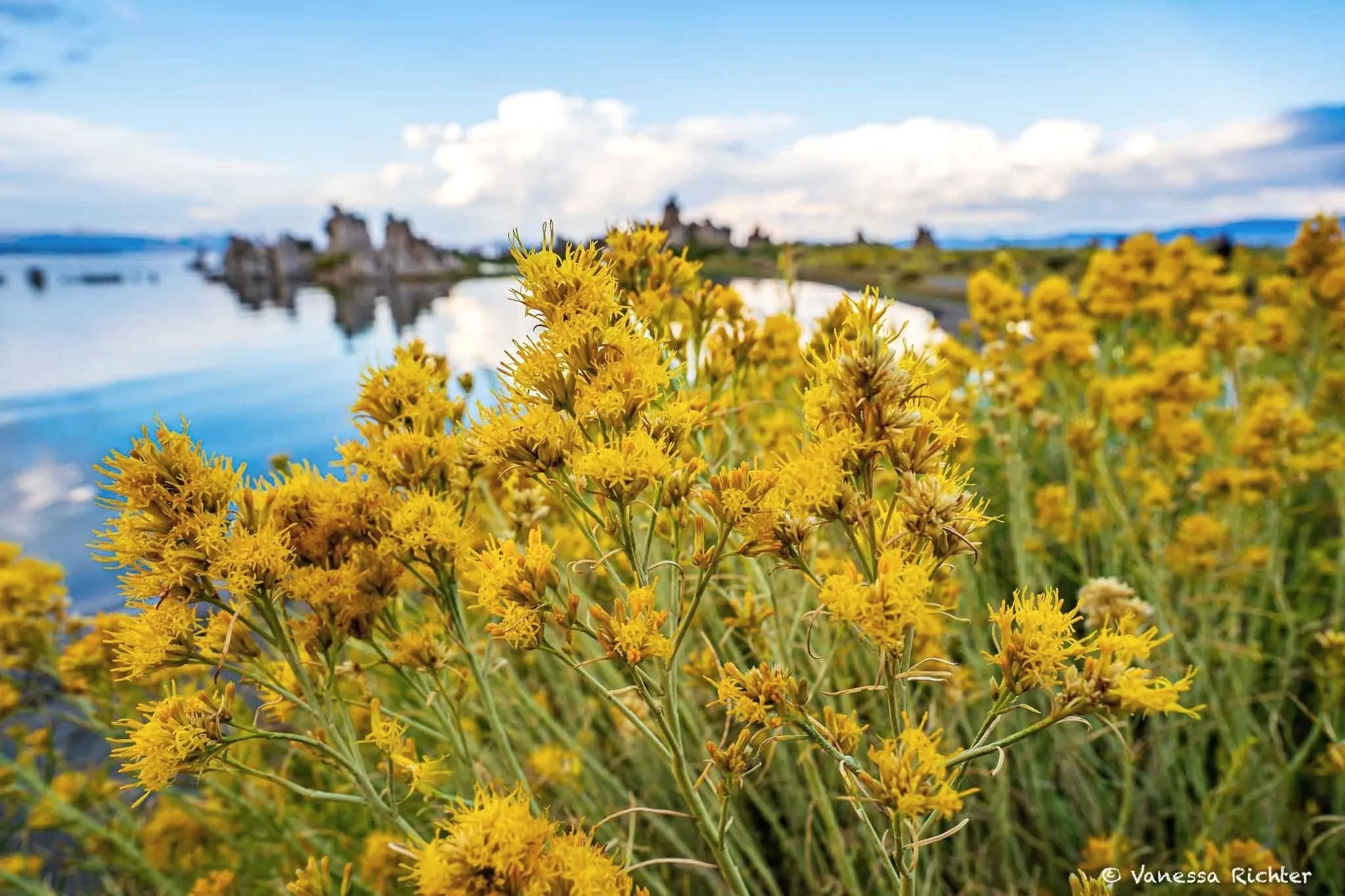
In late summer, rubber rabbitbrush turns the basin yellow.
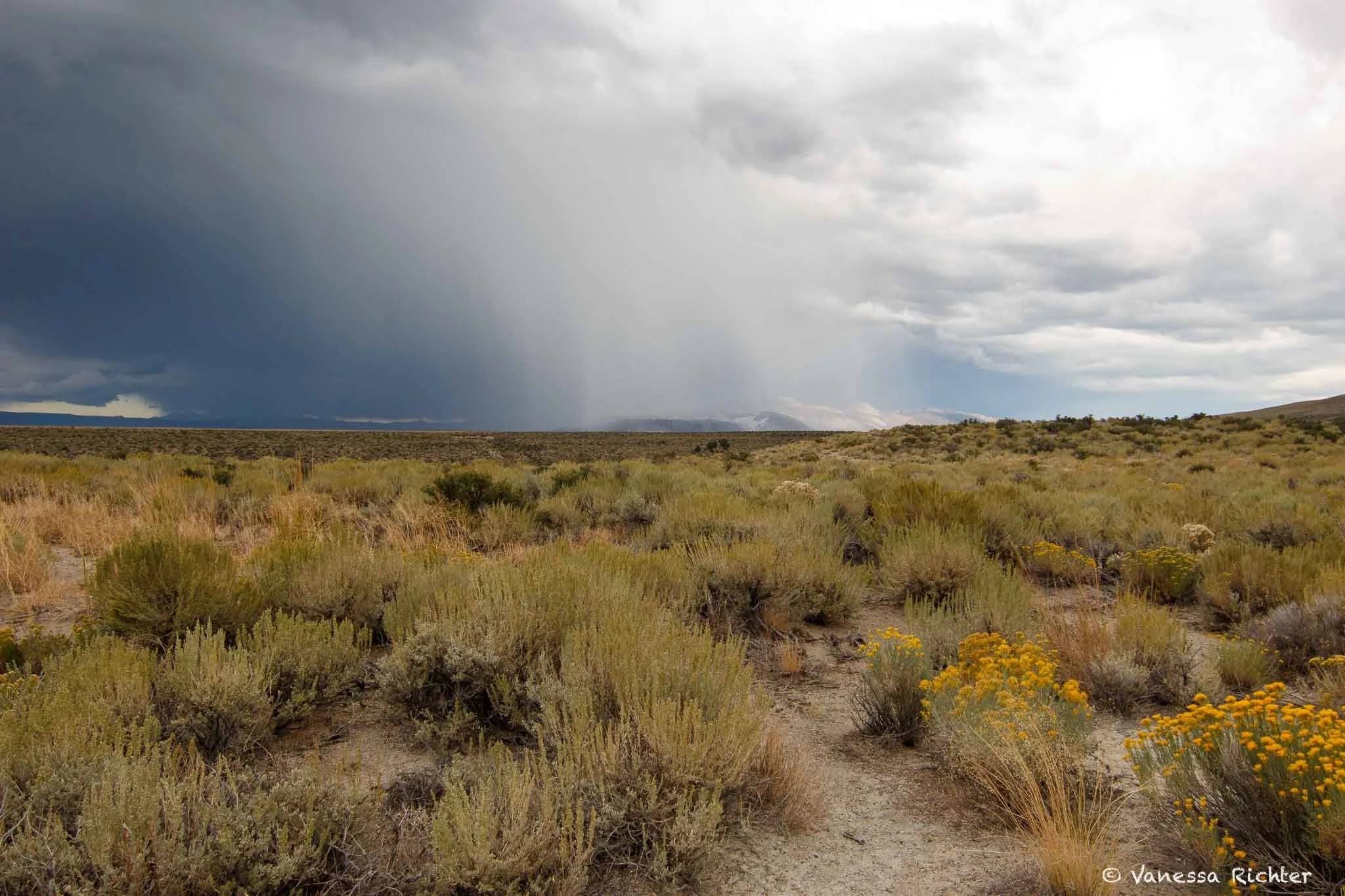
A sea of sagebrush and blooming rabbitbrush under storm clouds. The sagebrush will expel its calming scent when the rain hits its leaves.
🌼 Plant Spotlight: Prickly Poppy (Argemone munita)
🌵 Armed and beautiful. The prickly poppy is one of the most striking plants you'll encounter around the Mono Basin — standing up to five feet tall on fierce, spine-covered stems with mint-green leaves that are just as sharp. The Latin name munita means "armed," and the plant earns it.
🍳 The fried egg flower. Its large white blooms have six crinkled petals surrounding a dense ring of yellow stamens — so vivid against the dry landscape that it's earned a second nickname: the fried egg flower.
🐛 Better don't touch. The plant is toxic to humans and animals, and its yellow sap is an irritant. It is, however, an important larval host for several native moth species.
🏔️ A tough high-desert native. At home in dry, rocky, low-nutrient soils, it grows up to around 10,000 feet across California, Nevada, Arizona, and Baja California.
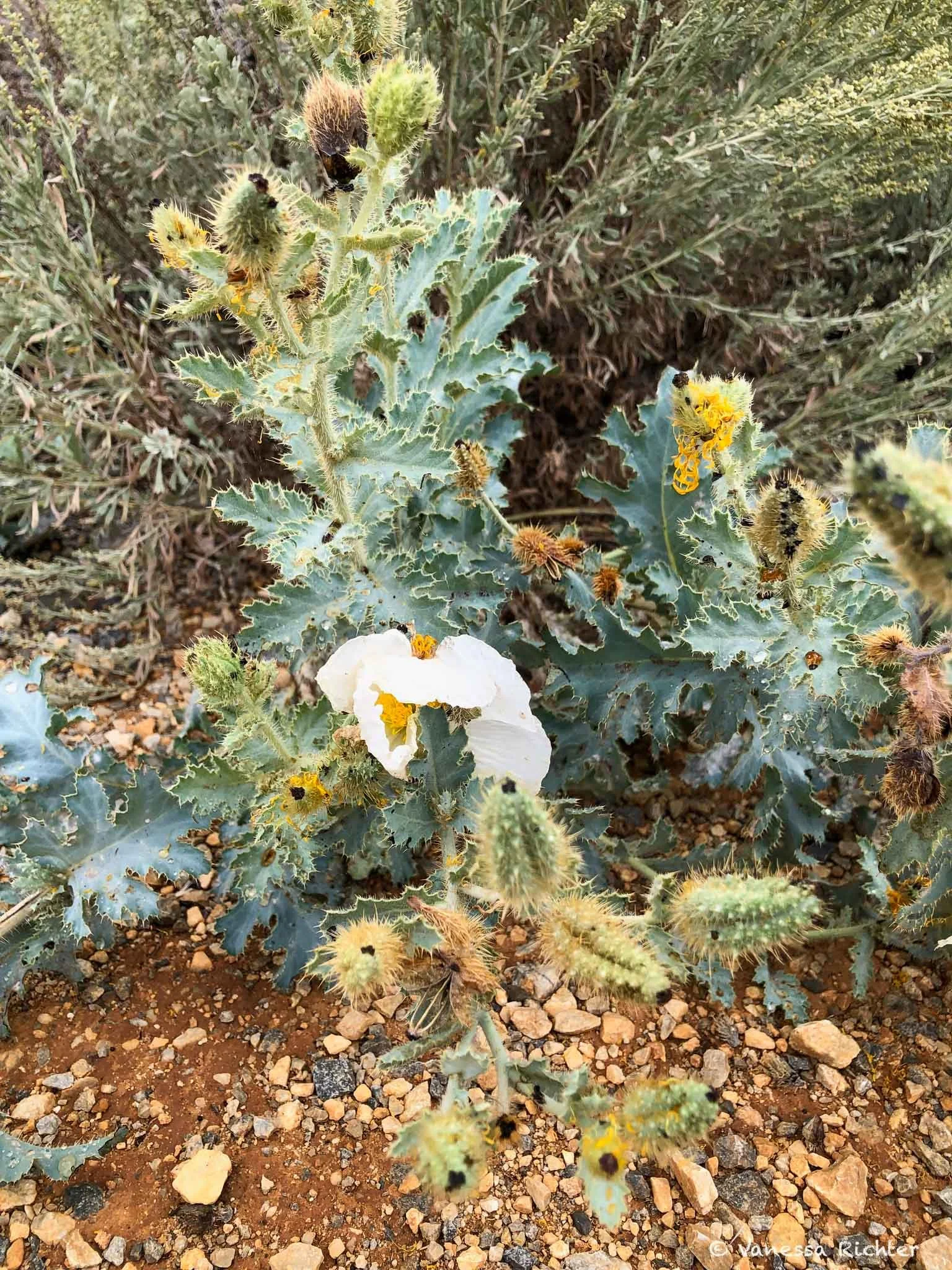
Look for the Prickly Poppy blooming from June through August.
The Fight To Save Mono Lake
Mono Lake has always been a lake in motion. Climate has always driven its level up and down — paleoclimate research has found ancient tree stumps still rooted in what is now the lakebed, evidence of medieval megadroughts that dropped the lake dramatically for centuries at a time. The tufa towers have been partially exposed before, during the driest of those long dry spells.
What changed in 1941 was different in kind. That year, the Los Angeles Department of Water and Power started diverting the lake's main tributary streams into the LA Aqueduct — a decision logical by the era's standards, made to supply a rapidly growing city. But with its inflow cut, the lake had no way to recover. Evaporation, which had always been balanced by the streams, now went unchecked. Over the next four decades the lake dropped more than 40 feet, losing half its volume and doubling in salinity. As a result, blown-up dust led to unhealthy air pollution and a new connection from Negit Island to the mainland allowed predators to roam between them, threatening the survival of the California Gull population at the lake.
The legal fight that followed is one of the more remarkable conservation stories in California history. The Mono Lake Committee, founded in 1978, and the National Audubon Society together brought the case that reached the California Supreme Court in 1983 — establishing that the state had a duty to protect the lake under the public trust doctrine — and built a campaign that eventually forced a reckoning. In 1994, the State Water Resources Control Board restricted Los Angeles's diversions and set a target lake level for ecological recovery. LA still exports water from the basin, but under strict limits tied to the lake's level.
Still, as of May 2026 it remains 9.2 feet below the 1994 mandated management level, a gap that ongoing drought and continued exports have made harder to close than originally projected.
🕰️ The Fight for Mono Lake: A Timeline
Mono Lake begins forming millions of years ago in a closed volcanic basin. Its level has always shifted with climate — rising in wet centuries, falling in dry ones. The organisms that live here evolved across those long, slow fluctuations, calibrating themselves to gradual change over millennia. What they are not built for is rapid, sustained loss. That distinction matters for what came next.
The LA Department of Water and Power starts diverting the lake's main tributary streams into the LA Aqueduct. With its inflow cut, the lake had no mechanism for recovery. Over the next four decades it dropped more than 40 feet, losing half its volume, and doubling in salinity.
Scientists and activists founded the Mono Lake Committee to build public awareness and pursue legal remedies. A long campaign — through courts, public hearings, and sustained organizing — begins.
In National Audubon Society v. Superior Court, the California Supreme Court rules that the state has a duty to protect Mono Lake under the public trust doctrine — establishing that water rights must be weighed against the public's interest in a healthy ecosystem, not treated as absolute. One of the most consequential environmental rulings in California history.
The State Water Resources Control Board restricts LA's diversions and sets a target lake level of 6,392 feet for ecological recovery. Los Angeles still exports water from the basin — but under strict limits tied to the lake's level.
As of May 2026 it remains 9.2 feet below the 1994 mandated management level, a gap that ongoing drought and continued exports have made harder to close than originally projected.
Plan your Visit
Know Before You Go
Park Structure & Access
- Mono Lake is managed jointly: the Mono Lake Tufa State Natural Reserve (California State Parks) protects the lakebed and tufa; the surrounding Mono Basin National Forest Scenic Area (Inyo National Forest) covers the land around it. Key sites are spread around the lake, not in one centralised park.
- South Tufa: $3 per adult (16+). America the Beautiful / Interagency Annual Pass accepted.
- Inn Fire (May 2025): The fire destroyed the State Reserve boardwalk at Mono Lake County Park. Check the Mono Lake Committee site for current status before visiting the north shore.
Best Time to Visit & Weather
- September–October: Often the sweet spot. Cooler, thinner crowds, fall colors along the creeks, and peak eared grebe migration on the lake.
- April–May: Quiet, with full creeks and first wildflowers. Weather can swing hard — late snowstorms are not unusual.
- June–August: Busiest. Plan hikes for early morning or late afternoon, carry water, use sun protection — there's no shade at South Tufa.
- December–March: Quietest. Snow on the tufa can be striking. Highway 120/Tioga Pass is closed (typically early November to late May or June), cutting off the western route to Yosemite. Current Tioga Pass status — NPS
- Elevation is roughly 6,400 ft at the lake — nights are cool even in summer and weather changes quickly.
Visitor Centers
- Mono Basin Scenic Area Visitor Centre — Highway 395, just north of Lee Vining. Exhibits on geology, ecology, and the water-diversion story. Seasonally open; typically closed December–March. The Old Marina trail starts here.
- Mono Lake Committee Information Centre — Downtown Lee Vining, Highway 395. Open year-round. Maps, books, guided canoe tour bookings, current conditions.
- Mono Lake Tufa State Natural Reserve — CA State Parks
Leave No Trace & Safety
- The tufa took centuries to form and can't be repaired once damaged — please don't climb, break, or collect any of it.
- Dogs are welcome on most Forest Service trails on leash, but not on the State Reserve boardwalks. When in doubt, check with a visitor centre.
- The lake is a working ecosystem for nesting birds. Keep at least 1 mile from any island April 1–August 1 during gull nesting season, and 200 yards from osprey nesting tufa April 1–September 1. Winds can build fast — stay near shore, and the Mono Lake Committee recommends being off the water by noon. Paddling safety tips
- The water stings. Salty and alkaline — keep it out of eyes and open cuts.
- Leave No Trace — The 7 Principles
Where To Stay Near Mono Lake
⛺ Camping
Camping is my favorite way to stay in the Eastern Sierra. There's nothing quite like pitching a tent in the woods, having a campfire going, and falling asleep to the smell of pine all around you. The Mono Lake area has plenty of options:
🎯 First-come, first-served
Many campgrounds around Mono Lake are FCFS, which is great if you don't always plan trips weeks in advance. The catch: they fill up fast on weekends, especially long holiday ones. People typically arrive Friday afternoon and stay through Sunday (or the respective holiday).
- Lee Vining Canyon campgrounds (Big Bend, Aspen, Lower Lee Vining) — the closest developed sites to the lake, set along Lee Vining Creek in a canyon below Tioga Pass. Primitive but beautiful, with easy access to town.
- Ellery Lake Campground — 12 sites at 9,500 ft on the road up to Tioga Pass, right beside an alpine lake.
📅 Reservable campgrounds
If you'd rather not roll the dice, a handful of campgrounds in the broader area can be reserved in advance through Recreation.gov. For summer weekends, reserve as early as you can — these book out months in advance.
- Tuolumne Meadows Campground (Yosemite) — an unbeatable location if you also plan to explore the Yosemite high country, right at the eastern edge of the park. Only accessible when Tioga Pass is open.
- Oh Ridge Campground (June Lake Loop, ~15 miles south) — large campground above June Lake with sweeping views of the surrounding peaks. Fishing, swimming, and the small town of June Lake within easy reach. Reserve on Recreation.gov
🌲 Dispersed camping
The Mono Lake area is surrounded by BLM and Inyo National Forest land where dispersed camping is allowed, meaning you can camp for free in many places as long as you follow the rules. If you've never done it before, do your homework first: you'll be fully self-reliant, which means bringing your own water, food, and shelter, and knowing how to handle human waste responsibly (Leave No Trace principles apply). Pay close attention to current fire restrictions — wildfire risk in the Eastern Sierra is real, and rules around campfires, grills, and stoves change throughout the season and require a permit. Both the Inyo National Forest and BLM California websites post current conditions.
🏠 Hotels & Motels
Prefer a roof and a real bed? Two nearby towns work well as a base:
- Lee Vining — a small town sitting right above Mono Lake, just minutes from Yosemite's eastern entrance. The best base if you want everything close by: restaurants, supermarket, gas station, EV chargers. Just be aware the town is very small and the few accommodations book out fast, especially on weekends when Tioga Road is open.
- June Lake — a bit farther south, on the way toward Mammoth Lakes. More accommodation options than Lee Vining, but puts you a little farther from both Mono Lake and Yosemite. A solid backup if everything in Lee Vining is booked, and a great base if you also plan hikes in that area.
Where we stayed · Lee Vining · Closest to Mono Lake
Murphy's Motel
Great location right in the middle of Lee Vining, friendly people, and spotlessly clean rooms. Not luxury, but it hits exactly the right notes for a Mono Lake trip — and we'd happily stay again.
Scan to book
Where we stayed · June Lake · Historic stay
Heidelberg Inn
The Heidelberg Inn has been around since 1927 and still has serious character — a four-sided stone fireplace with a grizzly bear on top is the centrepiece of the lobby. Units have kitchenettes and there's a hot tub on site, which makes it a great base for a multi-day stay.
Scan to book
All stays were personal stays, not sponsored. Booking.com and Vrbo links are affiliate — I earn a small commission at no extra cost to you if you book using my links, which helps keep me creating free resources like this one for readers like you.
🌿 The Naturalist's Kit
Turn a hike into a treasure hunt — the closer you can look, the more you know, the more there is to find.
Everything listed here is gear I actually use and recommend. Some of the links below are Amazon affiliate links, which means if you find a recommendation helpful and buy through my link, I receive a small commission at no extra cost to you. This is what makes free resources like this possible. If you liked my article and something here ends up in your pack, using my link is the best way to say thanks and keep this kind of content going.
👁️ Beyond the Naked Eye
One for what's far away, one for what's right under your nose.
🔭 Ultra-Compact Binoculars
My absolute essential on literally every hike, or pretty much anywhere I go. My go-to choice is super compact and lightweight — I don't even waste a thought about whether to bring them. I always do (if I don't forget them, because I am a headless zombie sometimes).
🔎 Magnifying Loupe
Super small and easy to forget you're carrying it. Check out the details of plants and rocks that are otherwise invisible to the naked eye.
📖 Know What You're Looking At
The tools that turn a hike into a discovery.
The best plant and wildlife ID tool out there. Photograph anything you can't identify, and the app suggests what it is based on your location. The community then confirms or corrects it. It is also a great way to contribute to citizen science, so the data can be used for research later. Free.
Open iNaturalist →Made by the Cornell Lab of Ornithology, Merlin identifies birds by listening to their songs in real time. Get your phone out on the trail and watch it name the birds singing around you. Make sure to download the bird pack for your region before you head out. Free.
Open Merlin →My go-to for finding and planning hikes. The free version gives you trail maps, reviews, difficulty ratings, and live GPS tracking while you have signal. AllTrails+ (paid) adds offline maps, wrong-turn alerts, and more detailed map layers. Check the recent reviews before you go for current conditions.
Open AllTrails →John Muir Laws' illustrated guide is THE ONE to carry for exploring the Sierra Nevada. The drawings are not only stunning but actually helpful in identifying what you see. It covers plants, insects, birds, mammals, and geology in a compact format — without adding significant weight to your pack.
Get The Laws Field Guide →In case you're interested in my full hiking gear setup, I've linked it here.
Beyond Mono Lake: Eastern Sierra Hikes & Yosemite's High Country
Mono Lake sits at the edge of two very different worlds: the high volcanic desert of the Great Basin to the east, and the granite peaks of the Sierra Nevada to the west. That makes it a great base for exploring the Eastern Sierra. The two hikes below are both around a 20-minute drive from Mono Lake and are situated in wilderness areas of Inyo National Forest, one being part of the Hoover Wilderness, the other of the Ansel Adams Wilderness.
Southwest of Mono Lake
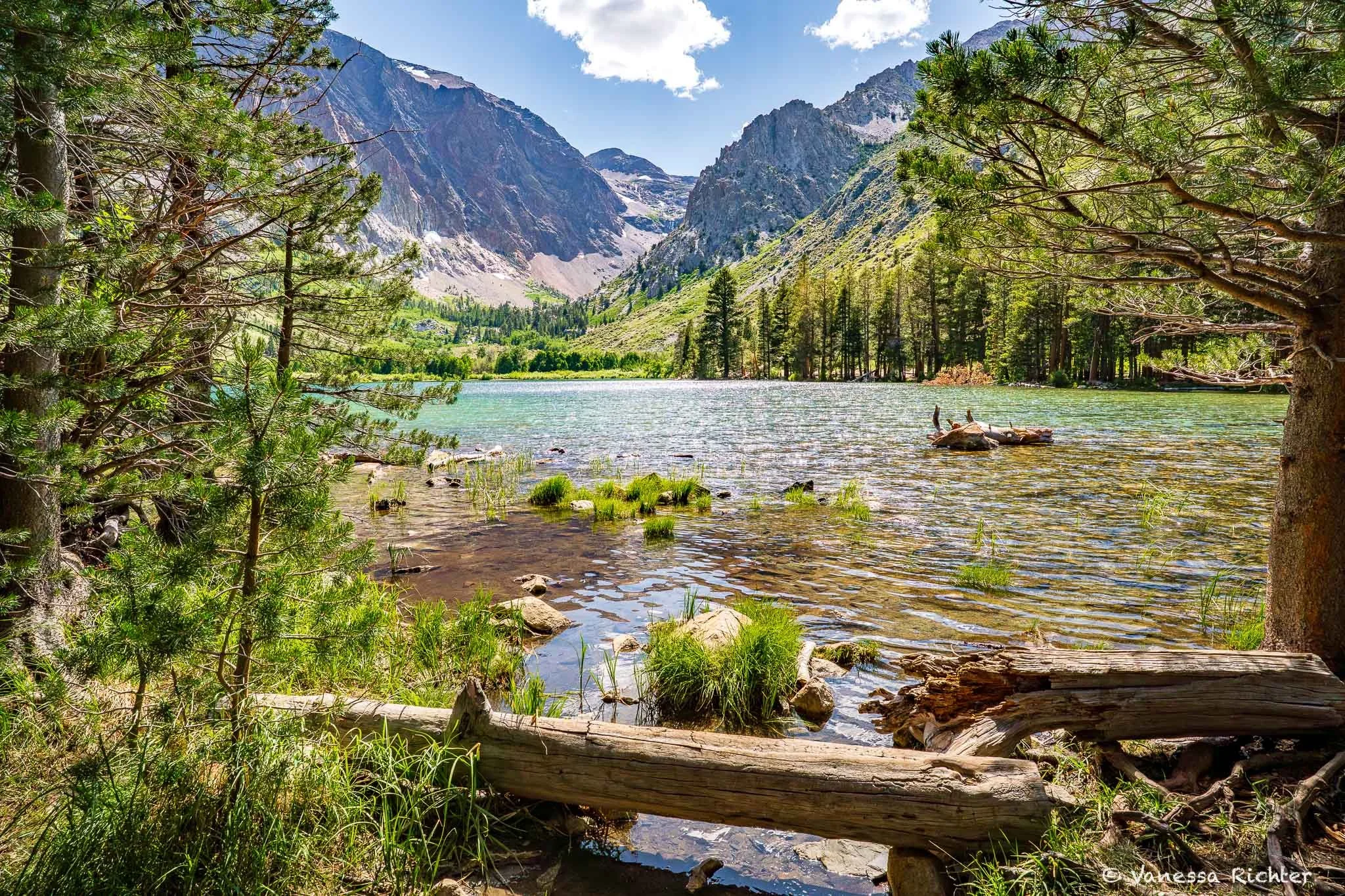
The Parker Lake Trail is located just south of Mono Lake and has a high effort-to-reward ratio: it is on the shorter side with very moderate elevation gain and striking changes in scenery as you'll hike from the desert toward the mountains of the Sierra Nevada to a stunning alpine lake. I particularly love this trail because it condenses a variety of habitats and there is so much to discover if you're open to noticing nature beyond the scenic views.
West of Mono Lake
The Twenty Lakes Basin and Saddlebag Lake hike sits west of Mono Lake just outside Yosemite's eastern entrance — you pass the turnoff as you head up Tioga Pass Road toward the park. This is a day hike, which can be quite challenging depending on when you go. We headed there in September after a very snowy winter and there was still old compacted snow obscuring the trail entirely in places, requiring some light scrambling. Also, the weather conditions along this trail can differ quite significantly as you'll pass along different sides of the mountains that can have different conditions locally. It is a stunning, moderate hike, but be sure to check conditions before heading out and come prepared for challenges along the way at certain times.

When you go farther west from Mono Lake along Tioga Road, you'll eventually enter the high country part of Yosemite, which has so many trails to offer and natural features to explore. Happy to hear if you're interested in an in-depth article about this whole area or a specific hike. Your feedback helps me a lot in finding out what folks are interested in.
I hope you enjoyed this article — by a real human for real humans. If you liked this guide, you can help me continue creating free resources like it.
Support
Follow the Adventure
Latest on the Blog

Looking For Something?