Hiking Twenty Lakes Basin and Saddleback Lake: Late Summer Adventure in Inyo National Forest
The Twenty Lakes Basin Loop is a stunning hike in the Sierra Nevada that begins at Saddlebag Lake and leads you through a series of breathtaking alpine lakes and scenery. Along the way, you'll be treated to impressive views of nearby mountain peaks.
In this article, I’ll take you along with me on this hike, which I did in late summer after a particularly snowy winter. The lingering snow patches, which persisted until September, made the hike both tricky and exciting.
Inyo National Forest · Eastern Sierra · California
Twenty Lakes Basin & Saddlebag Lake Loop
View on AllTrails →Scan for map & details
📏
8.0 mi
12.9 km
Distance
⛰
915 ft
279 m
Elevation
🔄
Loop
Route
It had rained a lot the day before. The sky was still a mix of dark clouds that seemed to predict a storm and blue skies that battled for letting the sun peek through the earth. The seemingly only café in the small town of June Lake was closed that morning, but a stunning rainbow (and if you look closely at the picture below, even a double rainbow) made up for it. Fortunately, our route to the trailhead passed through Lee Vining, just east of Yosemite on the way into Inyo National Forest, and we knew we'd find food there.
After a short 15-minute drive, we reached Lee Vining. Sheltered from the clouds with the mountains to the west, we were greeted by the sun. We found a small, and pretty café with a patio that felt like someone’s private garden. As this was so inviting, instead of hurrying up to get to our hike as quickly as possible, we decided to have our breakfast here.

The sun tries to win over the dark storm clouds, creating a rainbow in the early morning in June Lake.
From Lee Vining, the trail wasn’t far — just a short drive away, or so we thought. As it turned out, a local run was taking place that morning, and it felt like the entire town had shown up for it. Runners and walkers of all ages lined the roadside, some powering up the hill with determination, others chatting and laughing as they strolled along. We slowly wound our way past them, catching snippets of cheering, the shuffle of sneakers, and a good portion of enthusiasm and energy.
After a while, we took a right turn into the road that would finally lead us to the trailhead parking lot. Since I hadn't found any concerns in the reviews about the roads on this trip, we had decided to rent a compact car as I believed one with high-clearance would not be needed. So, I was surprised when the pavement ended and the smooth road turned into a rough dirt road with lots of large potholes and even larger rocks that forced us to drive really slowly. Even at a slow pace, we had to be really careful avoiding the larger obstacles as the car was pretty unforgiving. There was a small stretch of relief about halfway into this road, where it was paved, but that quickly changed again to the final stretch of dirt road. Slowly, yet steadily and without any bigger incidents, we made it to the parking lot. It was pretty abandoned, and there were only two other cars beside us. A couple seemed to have arrived shortly before us as they were just unloading their fishing gear.
It was chilly up here at an altitude of more than 10,000 feet. The clear blue sky had changed into a mix of dark clouds and sun that we also found in June Lake.
Would the weather hold?
I had read about people getting caught in a hailstorm halfway through, which I would very much like to avoid. This was one of the places where the weather appeared to be pretty unpredictable due to the mountainous landscape and the altitude, so there was no guarantee anyway. Yet, the weather forecast seemed to be in our favor, so we started hiking. The trail first took us around Saddlebag Lake before leading us into a sparsely vegetated forest just below the treeline. The trail ascended slightly up the hill and, because of the altitude, the minimal elevation gain felt much more strenuous than the incline itself suggested.
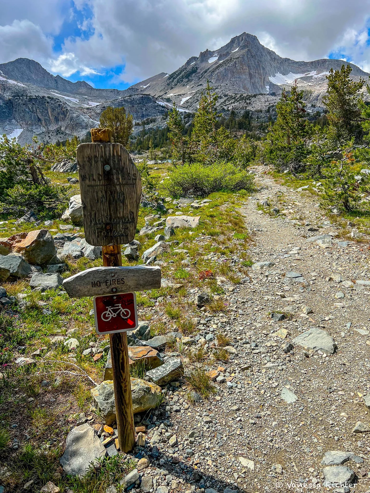
Welcome to the Hoover Wilderness.
Up to this point, we had met no one on this hike. These days, when most scenic trails get crowded with people, it felt like we had overlooked something.
Did others know something that we didn't?
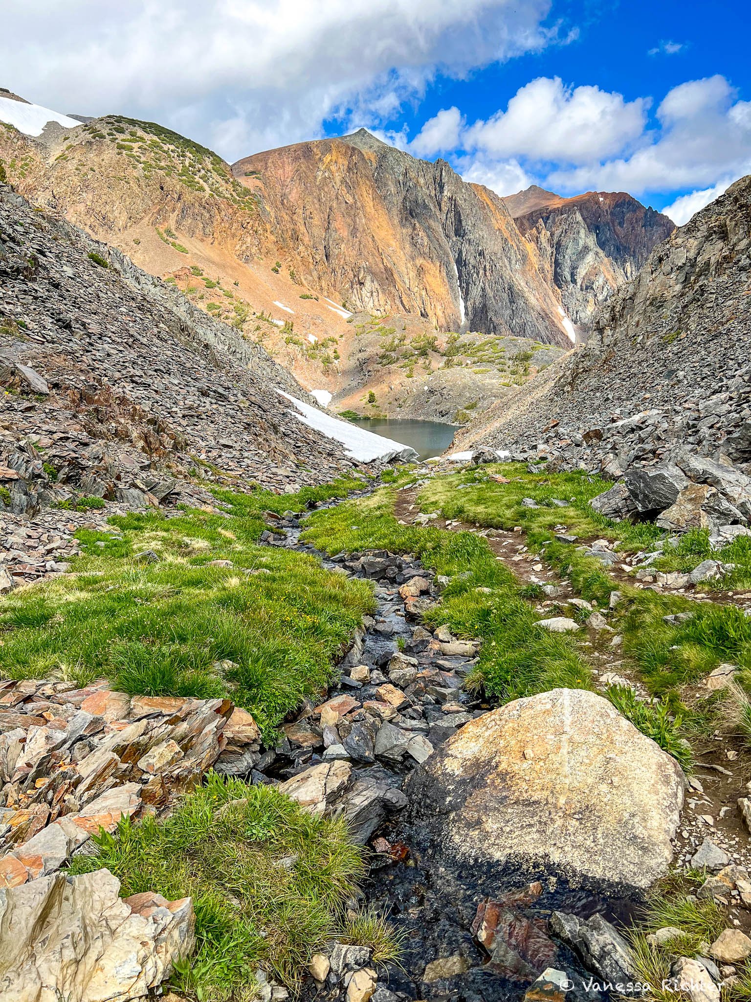
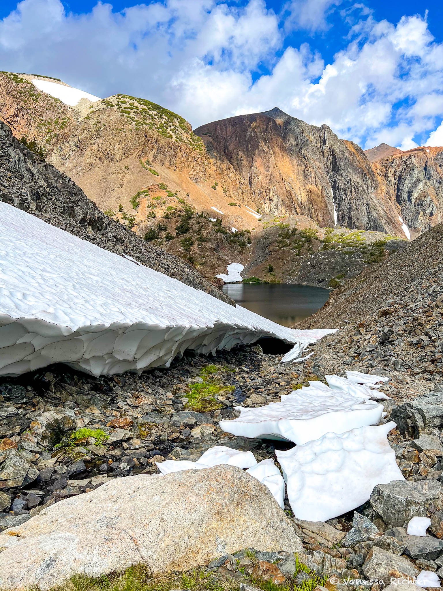
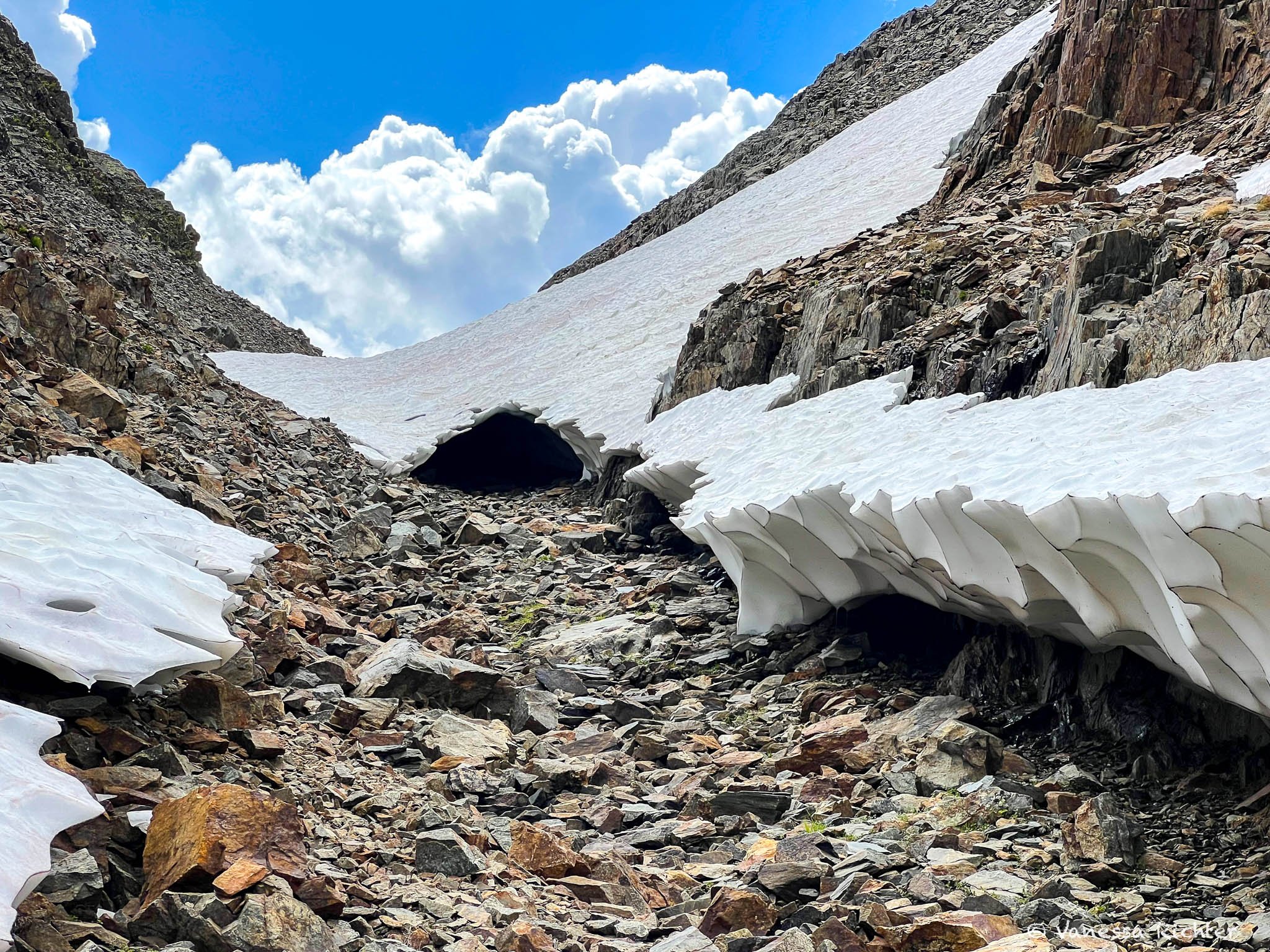
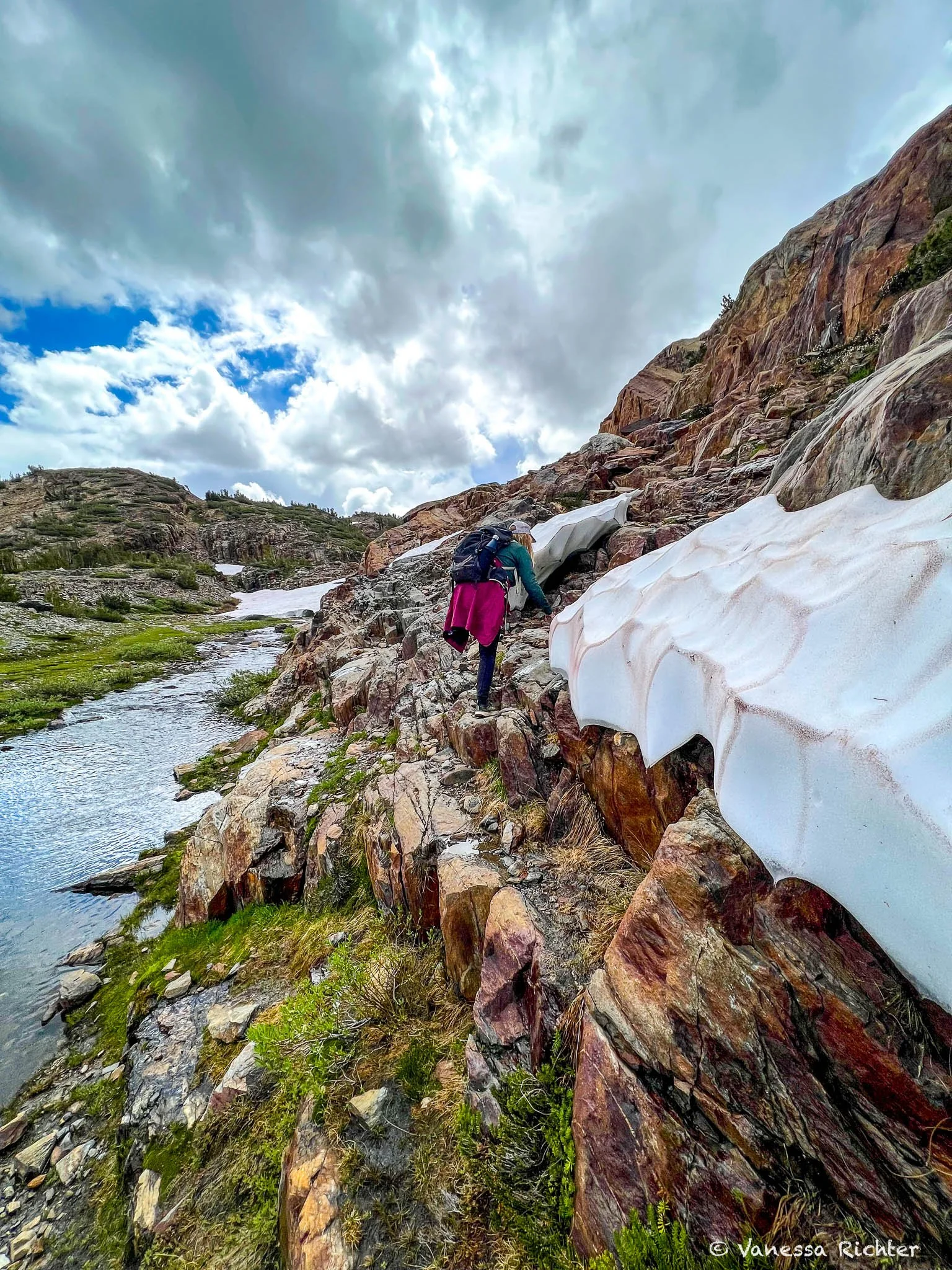
Surely, even now, at the end of summer were still a few snow patches on the trail, and the weather here was unpredictable and could potentially become dangerous. But no one? After all, it was such a beautiful hike! We continued until the trail took us between two rocky hillsides. A tiny, seasonal river had carved its way into the green grasses around. And there it was. The first big patch of snow, which was still in the process of melting away on this day at the end of summer after a crazy winter. As we came closer, we saw that it wasn’t just a snow patch, but something like a snowy ice tunnel had formed. The trail itself was hard to spot, but I believed that it usually went where the tunnel was now sheltering it. Obviously, going beneath the shallow and unstable tunnel wasn't an option, but it was perfectly doable to just walk on the hillside.
After navigating the ice tunnel, we swiftly arrived at Lake Helen. The sun briefly emerged and illuminated the lake (very briefly, so there is no picture of this). Still, we were alone, with no other humans in sight. We followed a narrow trail right along the shoreline with a rocky hillside to our right. Unease crept over me as the rocks felt dangerously loose, leaving us with no recourse but to leap into the freezing cold waters should an avalanche occur. Fortunately, this ominous scenario existed only in my head, and we safely reached the opposite end of the lake. We scrambled up a rock to get a little higher than lake level to continue our hike.

We had completed about half of the hike when we found ourselves in front of a rocky wall, where we could not make out any reasonable trail anymore. There was a tiny, probably seasonal river flowing through the valley as we looked up at a steep rocky mountainside. Trying to figure out how to get to the other side, we walked along the wall. We realized at some point that the actual trail was buried under snow, which was now compressed and as slippery as ice on a steep incline. Without microspikes, it would be extremely dangerous to attempt this path. We were left with two options: Go back halfway or somehow scramble up the wall. We decided on the latter, taking it one step at a time. Anytime we would have felt that there was no way to take the next step, we could still turn around. But sometimes, looking at the whole picture feels more intimidating than it actually is. After each step—or scramble, rather—the next seemed perfectly doable, and we reached the top of the mountain quickly. We were greeted by a sleet shower at the top, but that seemed to be a very local event, and we got out of it after a short walk towards Shamrock Lake.
Scrambling up the wall, one step at a time.
Here, we finally felt like we had completed the most difficult portion of this hike, and it was the perfect time to relax and have lunch. Easily, we found a pretty spot to sit down close to the lake, enjoying the views while eating.
After finishing more than half of the trail, we encountered other hikers for only the second time. They told us that they had been to Yosemite Valley the day before, and while this trail (and also the Yosemite National Park part on Tioga Road, which we visited the day before) was so quiet, the valley seemed to have been packed with people. With this experience in mind, it was almost unbelievable— even though I knew and have experienced myself how extremely popular the Yosemite Valley is.
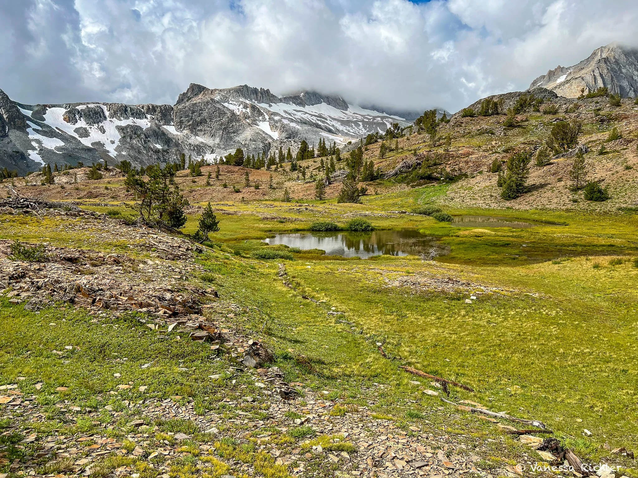
The second half of the hike proved to be less challenging, yet even more scenic, as we traversed numerous lakes, each more beautiful than the last. The alpine scenery was truly breathtaking: vast meadows with scattered vegetation including trees, and towering mountains. While a few more snow patches had to be crossed, they were situated on flat terrain, posing no significant obstacle.
After five hours, we returned to the parking lot filled with incredible impressions and excitement.
🥾 Essential Day Hiking Gear I Rely On
After years of trial and error, I’ve finally found hiking shoes that work across almost all terrains, a backpack that actually keeps my back cool, and a hydration setup that stays lightweight without sacrificing comfort. Plus, all the small things that make a hike noticeably more enjoyable. I’ve put everything together—from core essentials to the camera gear I rely on out on the trail.
→ See What I Actually Pack for Every Hike
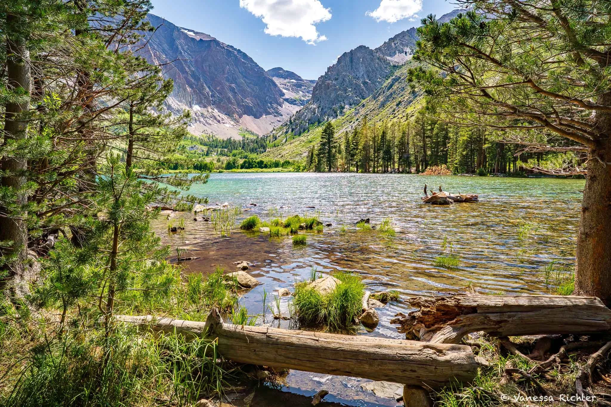
Beautiful mountain views on the final portion of the hike.
Know Before You Go
Access
- The trailhead is only reachable via Tioga Road (Highway 120) — whether you're coming from the west through Yosemite or from the east via US-395, you'll turn onto Saddlebag Lake Road off Highway 120 and follow the dirt road to the trailhead.
- Tioga Road is seasonal — it typically closes around November and reopens in late May or June depending on snowpack. Check current status at nps.gov before you go.
- The last stretch of the road to the trailhead can be rough — a higher-clearance vehicle is strongly recommended. We made it in a Honda Civic but scraped the bottom a couple of times even driving carefully.
Best Time to Visit
- Summer (July–August): Trail fully open and wildflowers in bloom. The Saddlebag Lake Resort water taxi has historically run during summer and can ferry hikers across the lake to shave roughly 1.5 miles off each direction — but the resort has had on-and-off seasons in recent years, so check its current status before counting on it.
- Early Fall (September): Cooler temps and fewer crowds. Even in years when it runs, the water taxi typically shuts down in early September — we hiked on September 10 and it wasn't operating.
- Late Fall–Spring: Tioga Road and Saddlebag Lake Road are typically closed due to snow. Check conditions before you go.
Trail Conditions & Safety
- High altitude: The trailhead sits at 10,118 ft (~3,084 m) and the trail tops out at 10,364 ft (~3,159 m). Above 8,000 ft, altitude sickness can affect anyone regardless of fitness or age — give yourself a day to acclimatize if you're coming from sea level. More info here.
- Mountain weather changes fast: Hailstorms and sleet are possible even in summer on a day that starts out clear, and storms here can be very localized. Check the forecast right before you head out.
- Snow patches linger: Conditions vary year to year. If there's any chance of leftover snow, bring microspikes — don't be like us and leave them in the car.
Leave No Trace
- Vault toilets are usually available at the trailhead.
- Dogs are welcome on leash.
- Stay on trail. The alpine vegetation here is fragile and slow to recover.
- Pack out everything you bring in. No bins at the trailhead.
Read On

Follow the Adventure
Latest on the Blog

Search
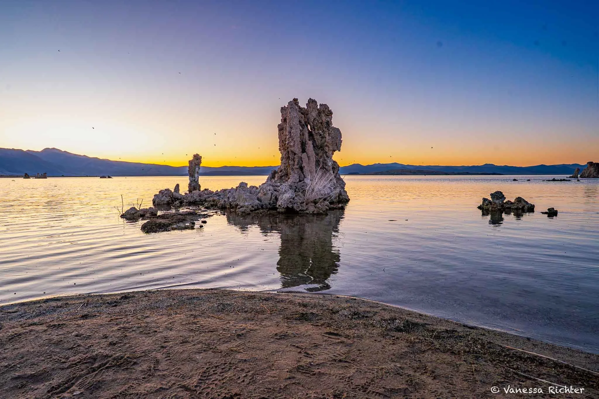
Mono Lake is one of the oldest lakes in North America — likely more than 760,000 years old and possibly over a million years old. For all that time, Eastern Sierra streams have been pouring in, carrying salts and minerals down from the mountains. With no outlet for roughly the past 80,000 years, water can only leave through evaporation, and the salts stay behind. A handful of species have evolved to thrive in exactly these conditions, and they do it in staggering numbers. I'll share how to best explore this special lake, plus all the details about its existence and the life it supports that make it so fascinating beyond its beauty.