
Best Hikes in San Francisco: Batteries to Bluffs Trail, Lands End & China Beach

The Batteries to Bluffs Trail and Lands End — including China Beach nestled between these trails — are my favorite hikes in San Francisco.
Thanks to San Francisco’s amazing location on the Pacific Ocean with its rugged shoreline, there are so many opportunities for outdoor lovers — even within the city’s limits.
In this article, I’ll delve into what to see along these trails, the stunning cultural history, and provide plenty of tips, so you can make the most of your visit!
Table of Contents
Lands End: Sutro Baths, Coastal Trail & Mile Rock Beach
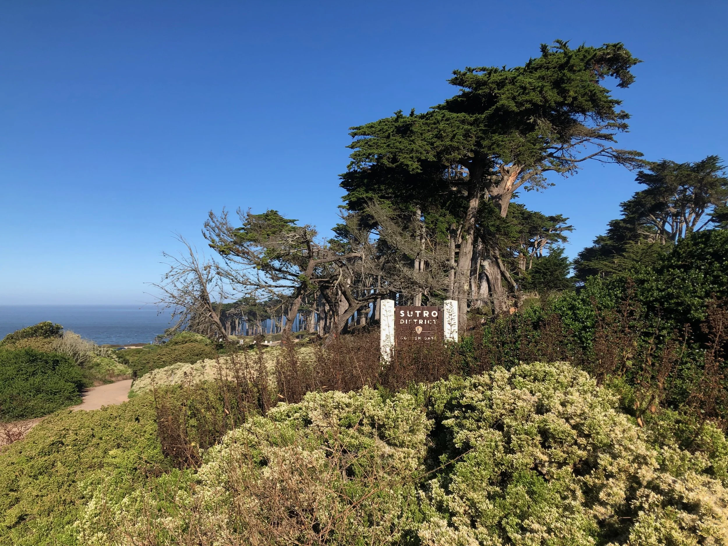
Lands End is located in the northwestern corner of San Francisco and it truly feels like what the name already suggests: being on the edge of the world — well maybe that is a little bit too dramatic — but it certainly allows you to escape the bustling city while immersing yourself in cultural history and natural beauty.
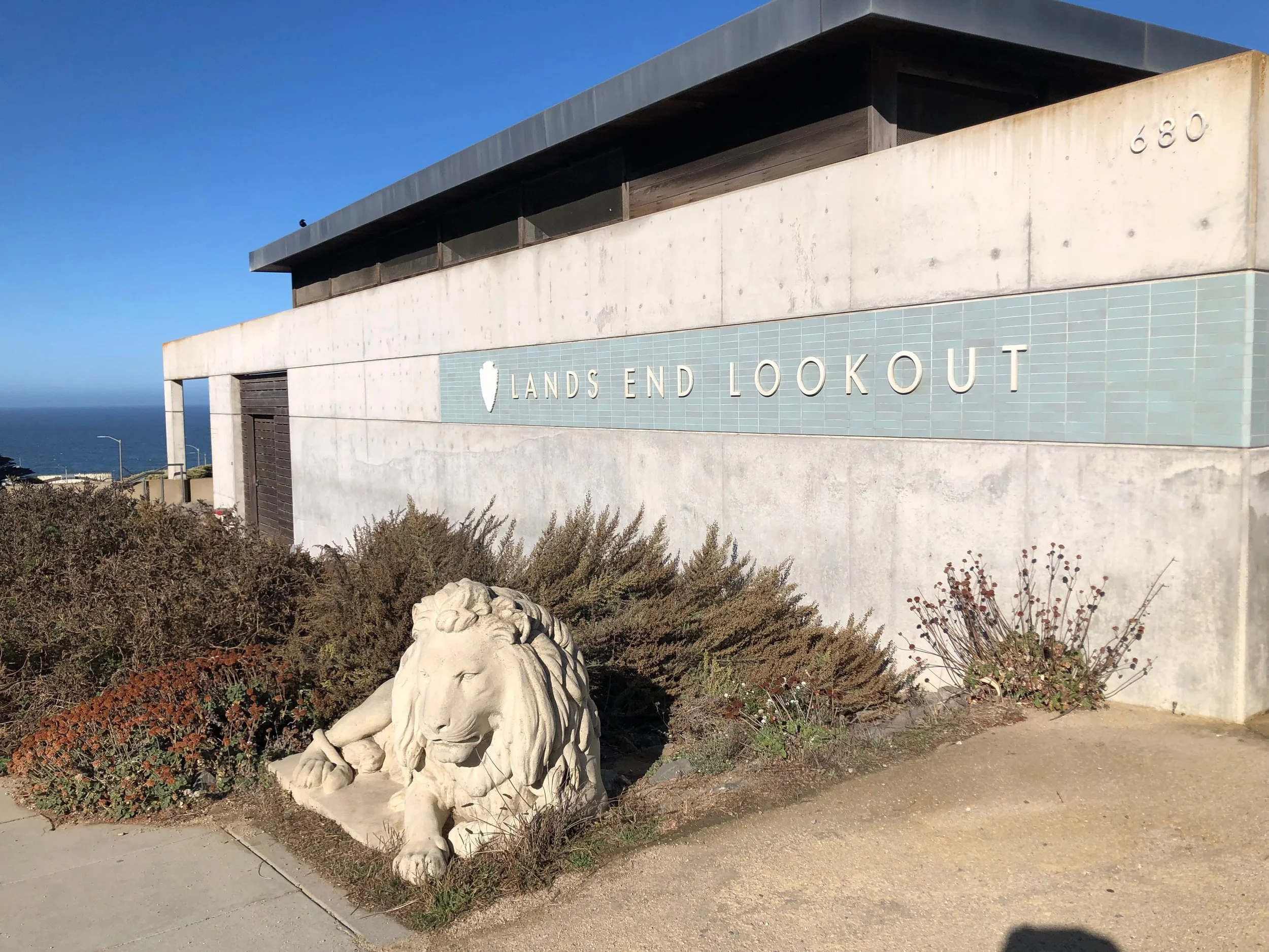
Before starting your hike, it is worth paying a visit to the Lands End Lookout Visitor Center, where you’ll find information about the history and nature of this area. Also, they have a pretty good selection of gifts, souvenirs, and books, so that is definitely worth checking out.
Let’s jump into the details!
Sutro Baths
Nowadays, Lands Ends feels like a rather secluded, natural place.
But about 130 years ago, that was all very different. Back then, Lands End attracted many visitors — not to do go on a hike and admire the coastal beauty — but rather to go to a concert, visit an art exhibit, or swim in one of several different temperate pools.
All of these activities were part of a huge complex.
If you find that fascinating as well, start the Lands End hike with exploring the remains of the once-gigantic Sutro Baths. Their developer and namesake, former San Francisco mayor and wealthy entrepreneur Adolph Sutro, initiated the construction in 1894. Two years later, the seawater baths were completed. The structure was further extended into a massive complex of over 3 acres that included seven oceanwater pools at various temperatures, slides, springboards, stadium seating for up to 3,700 guests, as well as natural history exhibits, galleries, restaurants, and many other recreational and educational opportunities. The Baths could accommodate 10,000 people at one time and offered 20,000 bathing suits and 40,000 towels for rent. Crazy, right?
From Glory to Decline: Challenges After Sutro's Era
At the time of its opening, Sutro Baths were virtually unrivaled in the United States in scale, technical achievement, and modernity. After Sutro’s death in 1898, his family continued managing the property. However, factors such as the Great Depression and the reduction in available public transportation (the baths were once served by two rail lines; the Ferries and Cliff House Railroad ran along the cliffs of Lands End overlooking the Golden Gate) led to a decrease in popularity. Attempts, such as converting the baths into an ice-skating rink, were not successful. In 1964, the land was eventually sold to developers who planned to replace the baths with high-rise apartments. Two years later, during the ongoing demolition of the baths, a fire destroyed the remaining structures, and the apartment plans were abandoned.
Legacy in Ruins: Sutro Baths today in the Golden Gate National Recreation Area
The ruins of the Sutro Baths have been part of the Golden Gate National Recreation Area since 1973. Though there is not much left of the once-enormous complex, I find it fascinating to wander around the ruins and imagine what it was like to visit this once-fancy place about 130 years ago when life was so different than it is today.
Read more on the website of the National Park Service.
More than 100 years ago, there was a gigantic complex at this site encompassing several sea- and freshwater pools and many more educational and recreational facilities. Today, you can wander around the ruins and try imagine what once was.
Coastal Trail
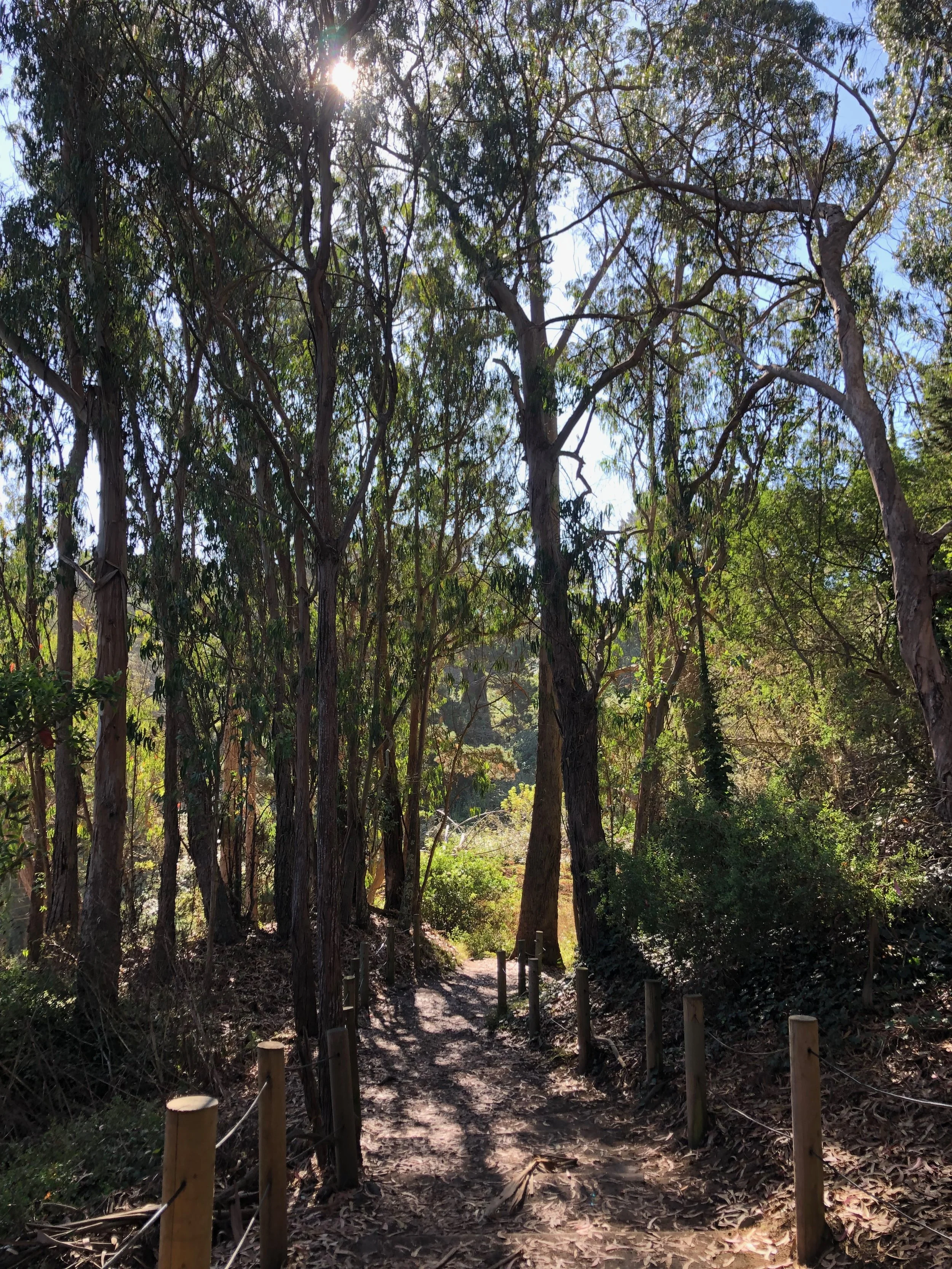
After visiting Sutro Baths, the hike continues along the picturesque Coastal Trail, perched atop the stunning Pacific coastline. This trail offers many amazing views, but also leads to hidden gems along the way. The trail goes along cypress as well as eucalyptus trees and grassy areas. There are several overlooks that provide a great view of the coast and the Golden Gate Bridge. It can get busy especially during the weekends and in summer as it is a popular trail for both tourists and residents.
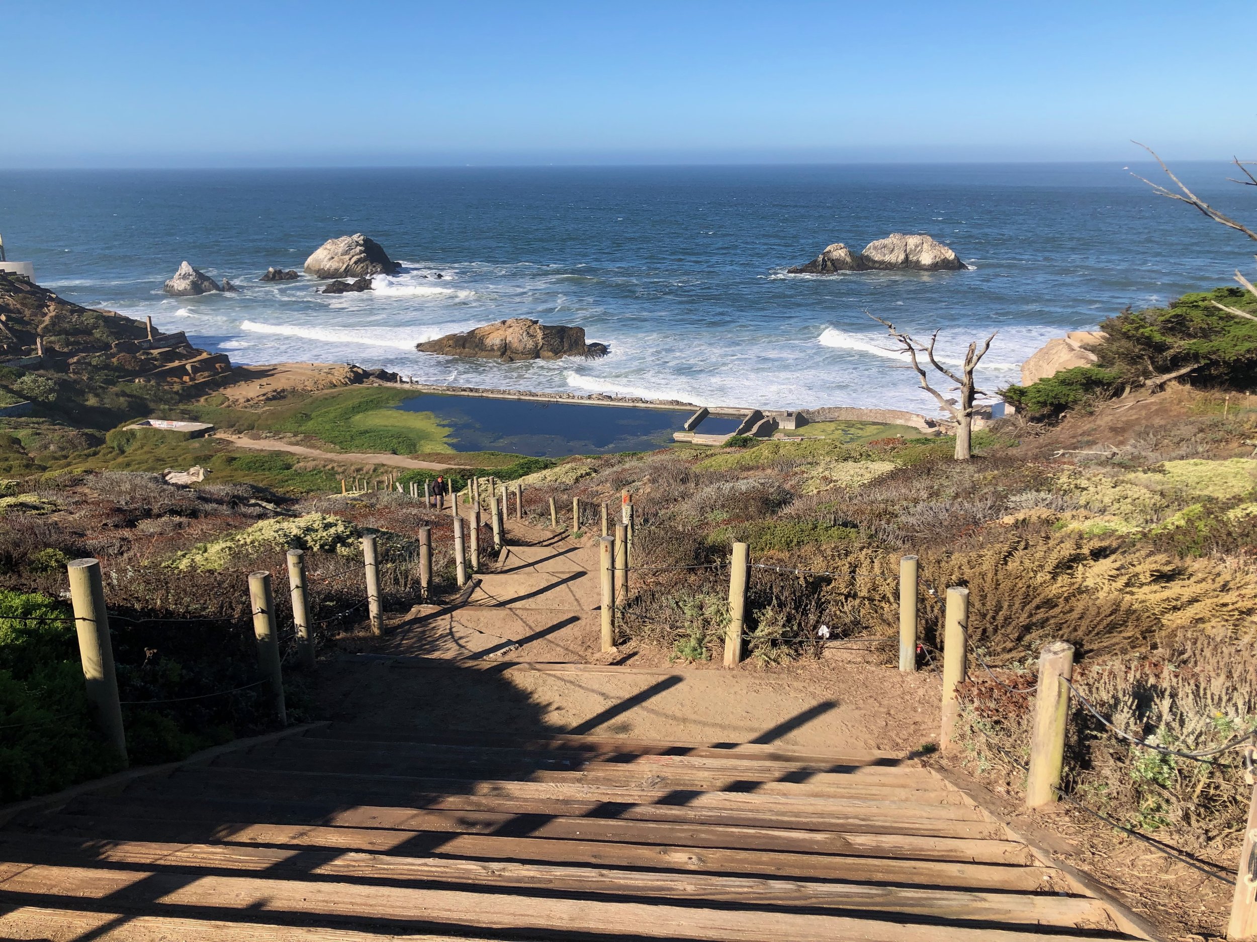
Mile Rock Beach
Descend (and later ascend) numerous stairs that lead to Mile Rock Beach, a small and secluded cove along the rugged shoreline. It is quite a few steps to get down to the beach, so going up is a nice little workout, but if you love beaches and views, it is definitely worth going!
Beautiful views from a viewpoint toward Mile Rock Beach and the Golden Gate Bridge.
Once you have reached the end of the trail, you have basically three options:
Hike back the same trail
Return on the El Camino Del Mar and visit the Legion of Honor, which is an art museum, featuring, for example, French impressionist paintings, Ancient Greek sculptures and contemporary African textiles. For more information on the museum, please check out their website. Please find map and trail navigation of Lands End loop including the Legion of Honor, on AllTrails.
My preferred option if you have the time: Continue through the Sea Cliff neighborhood and venture further towards the Golden Gate Bridge on the Batteries to Bluffs Trail and check out several scenic beaches along the way!
China Beach
Tucked in between Lands End and the Batteries to Bluffs Trail, lies China Beach in the picturesque Seacliff neighborhood. From the beach, you’ll have great views of the Marin headlands and the Golden Gate Bridge. According to local legend, China Beach earned its name from the Chinese fishermen who, a long time ago, would moor their junks in the cove and make camp along the shore.
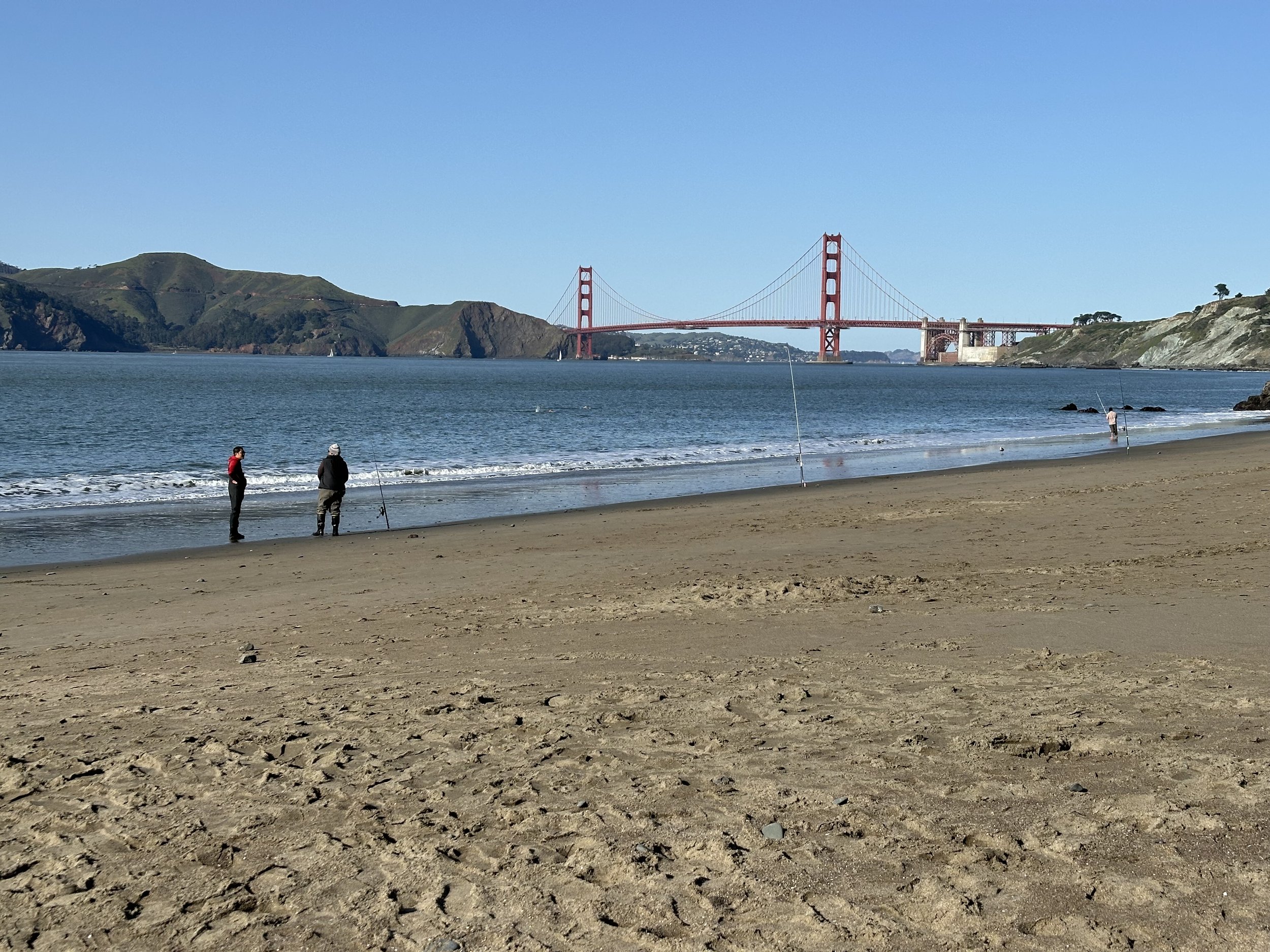
A low-key day at China Beach: Only a few fishermen are waiting for a good catch.
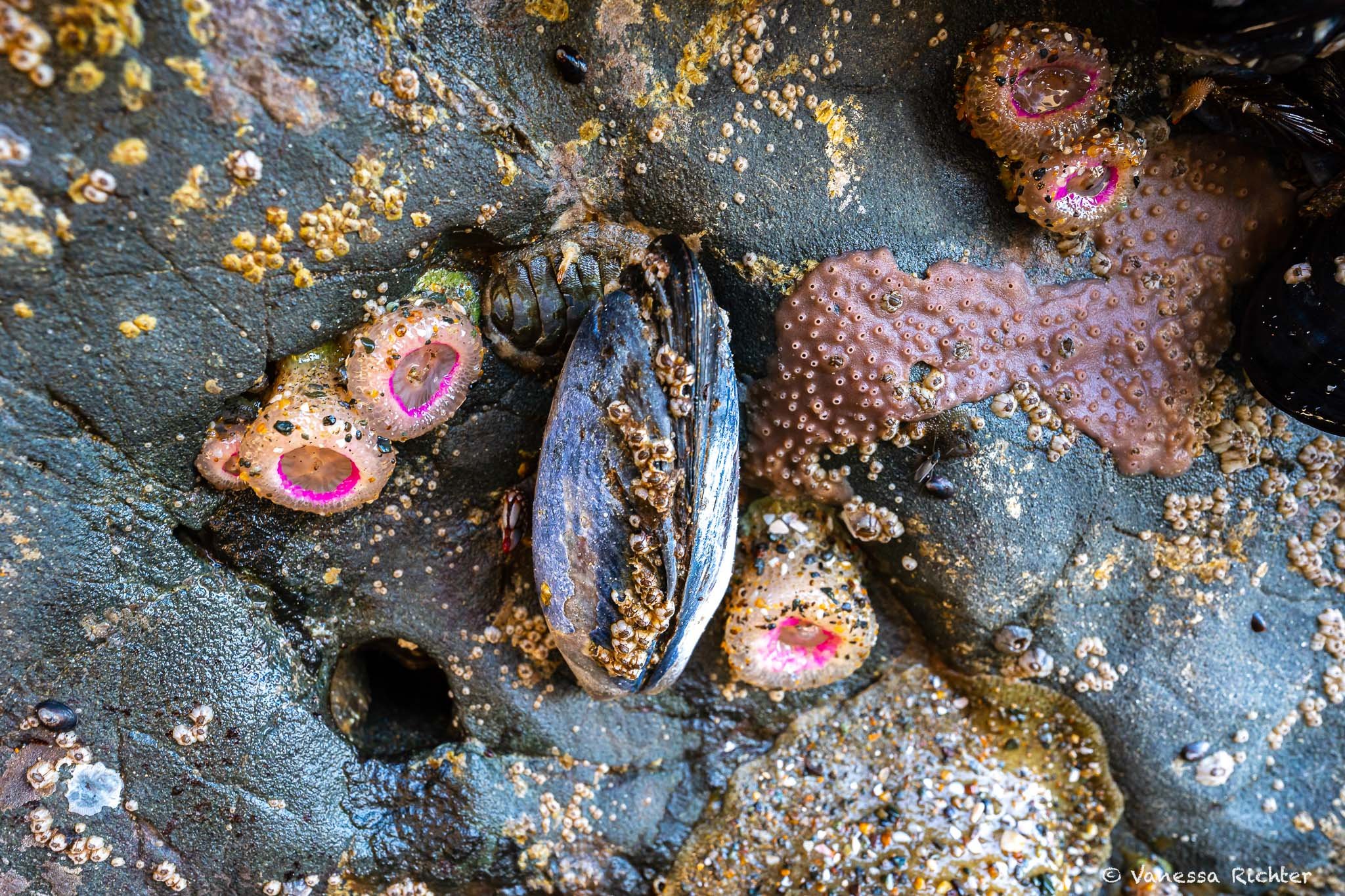
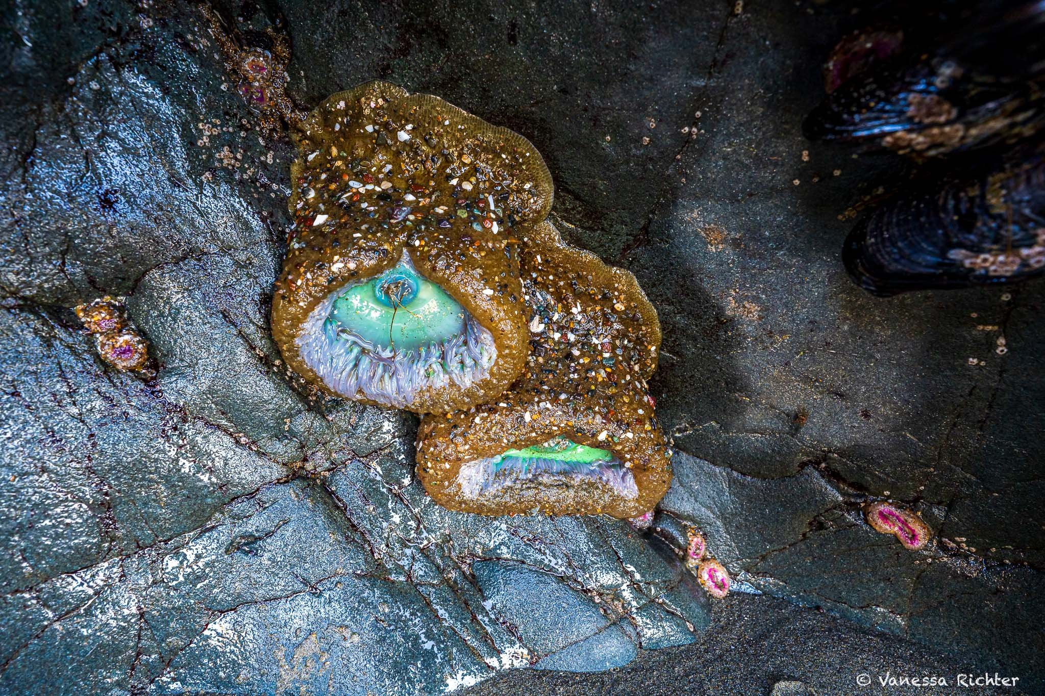
The best time to visit the beach is undoubtedly at low tide, when you can walk between the large rocks on the east side of the beach. If the tide is very low, you can even walk directly from China Beach to neighboring Baker Beach. Along the way, there is plenty of marine life — mussels, sea anemones and other creatures— to be spotted, sitting patiently on the rock faces waiting for the seawater to return. Just look around the moist, shady rock faces towards the bottom. It is so fascinating to see!


Amazing view toward the Golden Gate Bridge on the way between China Beach and Baker Beach (only accessible during very low tide).
If you want to learn more about tide pooling in general and in the area around San Francisco, you might be interested in my article on the Best Tide Pooling Spots Near San Francisco.

At low tide, Baker Beach is just a short stroll on wet sand away from China Beach.
Rehabilitation Project
Currently, a major rehabilitation projectof the China Beach facilities is underway, which began in May 2023 and is still in progress as of May 2026. The parking lot and upper area have been completed, but work on the lower terrace and the new bathhouse remains to be done.
Don’t let the construction at the site deter you from visiting the beach. Beach access is available.
Batteries to Bluffs Trail
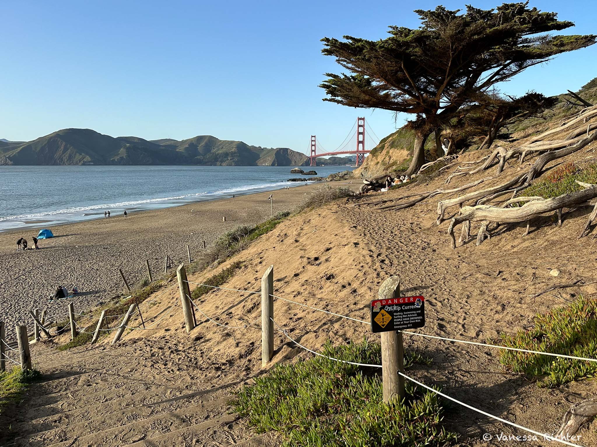
Baker Beach
This relatively large beach is the first stop before reaching the Batteries to Bluffs Trail. When it's warm and not too foggy or windy — which most commonly occurs in fall or spring — it is a popular spot for people to sunbathe, have a picnic, observe marine wildlife, or play in the sand.
On the way down to Baker Beach, you'll already enjoy stunning views of the coastline.
The most direct way to reach the trail from Baker Beach is by taking the so-called Sand Ladder, essentially a staircase at the north end of the beach. The steps are made of sand and held together by stringed-together logs of wood. While climbing a typical staircase with many steps can already be a sweaty exercise, this one adds a whole new level to the workout. Perhaps that's why this ladder is popular not only with hikers but also with runners going up and down the stairs.
Once you've reached the top, take a deep breath while soaking in the views, then make a left turn on Lincoln Boulevard. You will soon see the actual starting point of my personal favorite hike in San Francisco: the Batteries to Bluffs trail.
Alternatively, you can also reach the starting point of the hike by walking up the more gentle California Coastal Trail closer to the parking lot.

Many sandy stairs lead up from Baker Beach to the Batteries to Bluffs Trail.
Why is the Batteries to Bluffs Trail my favorite hike in SF?
What Makes it so Special?
That’s simple: incredible views along the ENTIRE way, always featuring the Golden Gate Bridge, the rugged coastline, the ocean, and often countless pelicans flying over your head.
I remember the very first time I did this hike so well. I can't even call it hiking, as I stopped every 20 seconds, either to snap a picture or just admire the beauty of the scenery. And this is not even exaggerated! At some point, I realized that I’d still be hiking tomorrow if I continued like this, so I tried to enjoy the scenery while walking a bit more consistently (which was a very hard task to do!). Sure, one could say — no wonder at this time as I came right out of a German winter, which is insanely depressing, but I did this hike several times after this, and the admiration has stayed!
If I had to give only one recommendation to see the Golden Gate Bridge and the San Francisco coast, this is it!
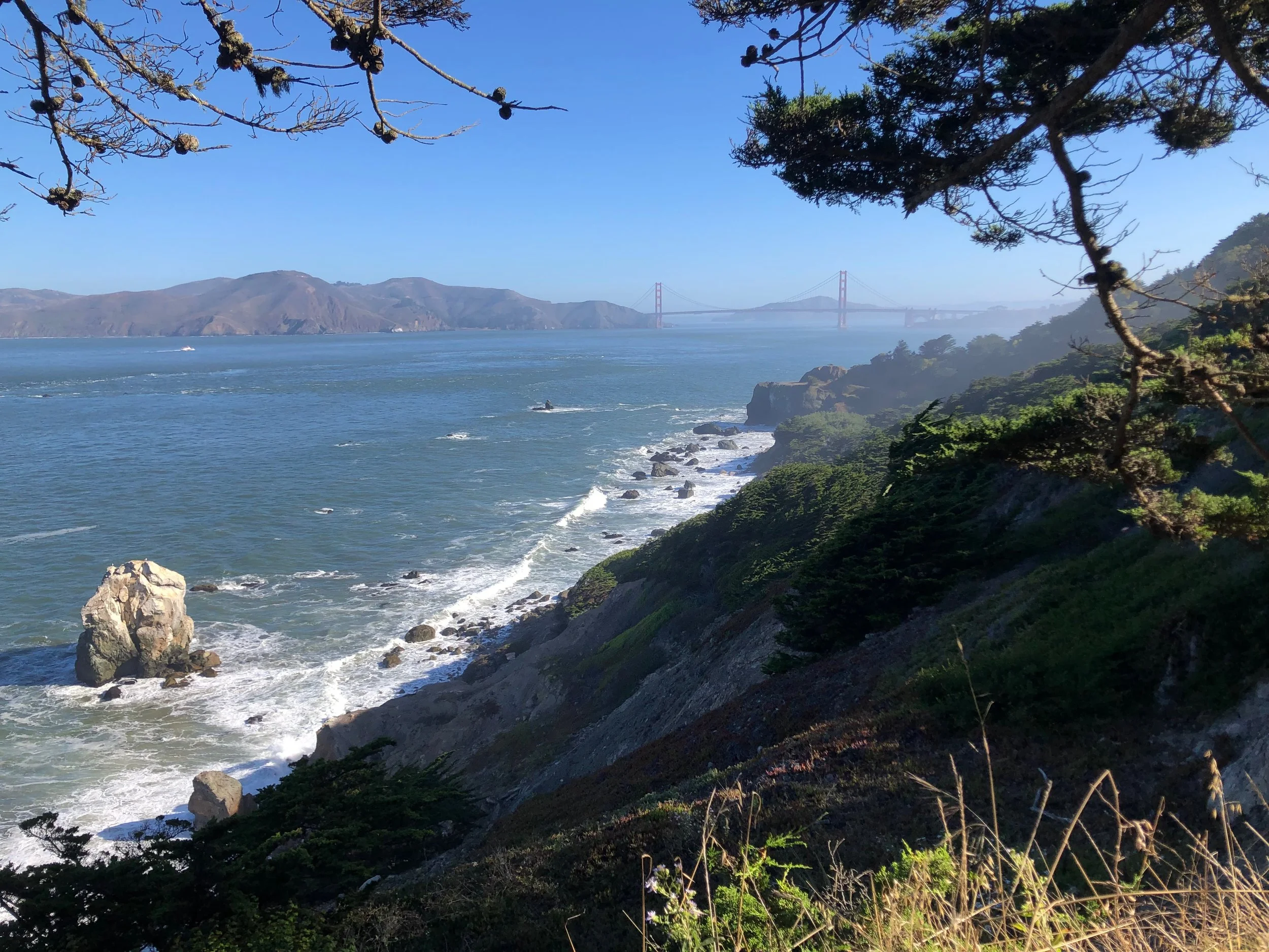
The trail features hundreds of stairs winding through the rugged shoreline. Even though you are technically still in San Francisco, it feels like such a secluded place. The blue-gray-greenish shining rocks that blend together with the green of the vegetation and the sandy hillsides are Serpentinite, which is is a rare rock type mainly formed in subduction zones (where one tectonic plate slides beneath another). These deep-sea rocks underwent alteration due to pressure and hot fluids in the subduction zone, eventually reaching the surface through uplift after the subduction process ended. The lighter weight of these altered rocks causes them to rise and appear at the Earth's surface. Because of the unusual soil chemistry, endemic plants highly adapted to this very specific composition evolve in such places.
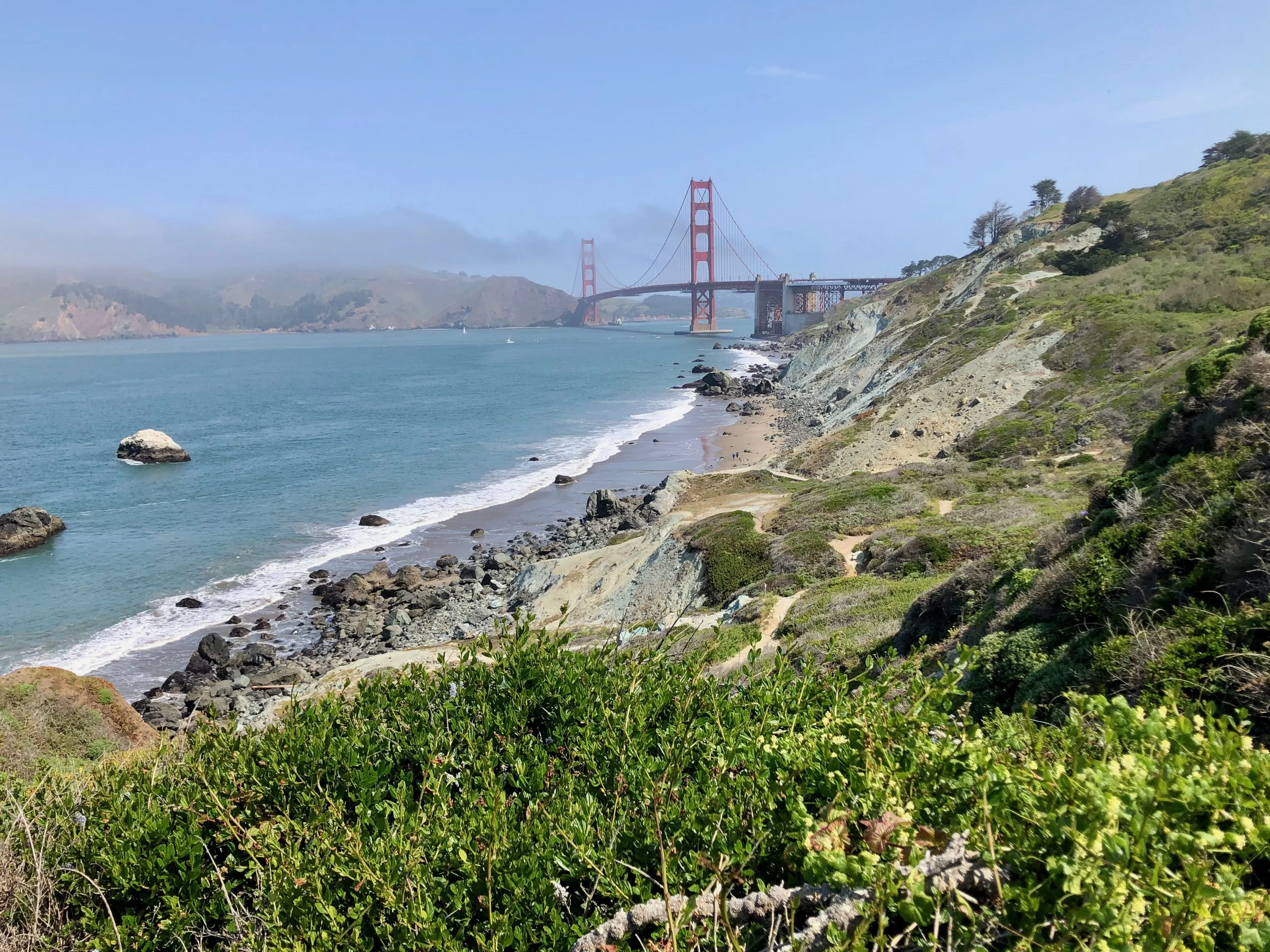
The sections of the rock faces exhibiting an uncommon gray-blue-green hue are composed of the rare Serpentinite.

View toward Marshall’s Beach and the Golden Gate Bridge from the Batteries to Bluffs Trail.
Marshall’s Beach
After hiking many stairs and inclines, down and up, you’ll arrive at a crossing to continue further toward the Golden Gate Bridge, or make a short detour to Marshall’s Beach. Strolling down a short path of 0.5 miles off the Batteries to Bluffs trail will lead you there. The beach features many large rocks, while being very close to the Golden Gate Bridge. Because of this, it is one of the best places to snap a photo of the iconic bridge.
This is one of my— if not the — favorite beach(es) in San Francisco, as you can even find some solitude in this incredibly beautiful setting with the Golden Gate Bridge, views of the Marin Headlands, shorebirds occasionally feeding at the beach, and the large rocks; at least if not visiting during peak times. This is because you will only get there by foot — either from the Golden Gate Bridge plaza or Baker’s Beach, which have the closest parking lots and bus stops nearby. Hence, there are also no amenities (i.e. restrooms or water) available at this beach.
At high tide, you won’t see a lot of the beach which is then submerged underwater. So, you’d rather have to scramble along the rocks to avoid taking a dive into the ocean or stay safe at a higher vantage point above the beach, which also offers an amazing view.

A beautiful winter evening unfolds at Marshall’s Beach, bathed in the golden hues of sunset and low tide. The spot captured in the photo is accessible only during (very) low tide.
🥾 Essential Day Hiking Gear I Rely On
After years of trial and error, I’ve finally found hiking shoes that work across almost all terrains, a backpack that actually keeps my back cool, and a hydration setup that stays lightweight without sacrificing comfort. Plus, all the small things that make a hike noticeably more enjoyable. I’ve put everything together—from core essentials to the camera gear I rely on out on the trail.
→ See What I Actually Pack for Every Hike
Golden Gate Bridge
From Marshall’s Beach, climb up some more stairs. Once you’ve reached the top, you’ll find additional batteries and excellent photo opportunities of the Golden Gate Bridge along the trail. Once you’ve reached the freeway going across the bridge, you can continue through the tunnel to get to the other side, where you’ll find the Golden Gate Bridge Welcome Center with gifts, books, and other souvenirs. You’ll also find restrooms, a cafe, as well as information on the bridge itself.
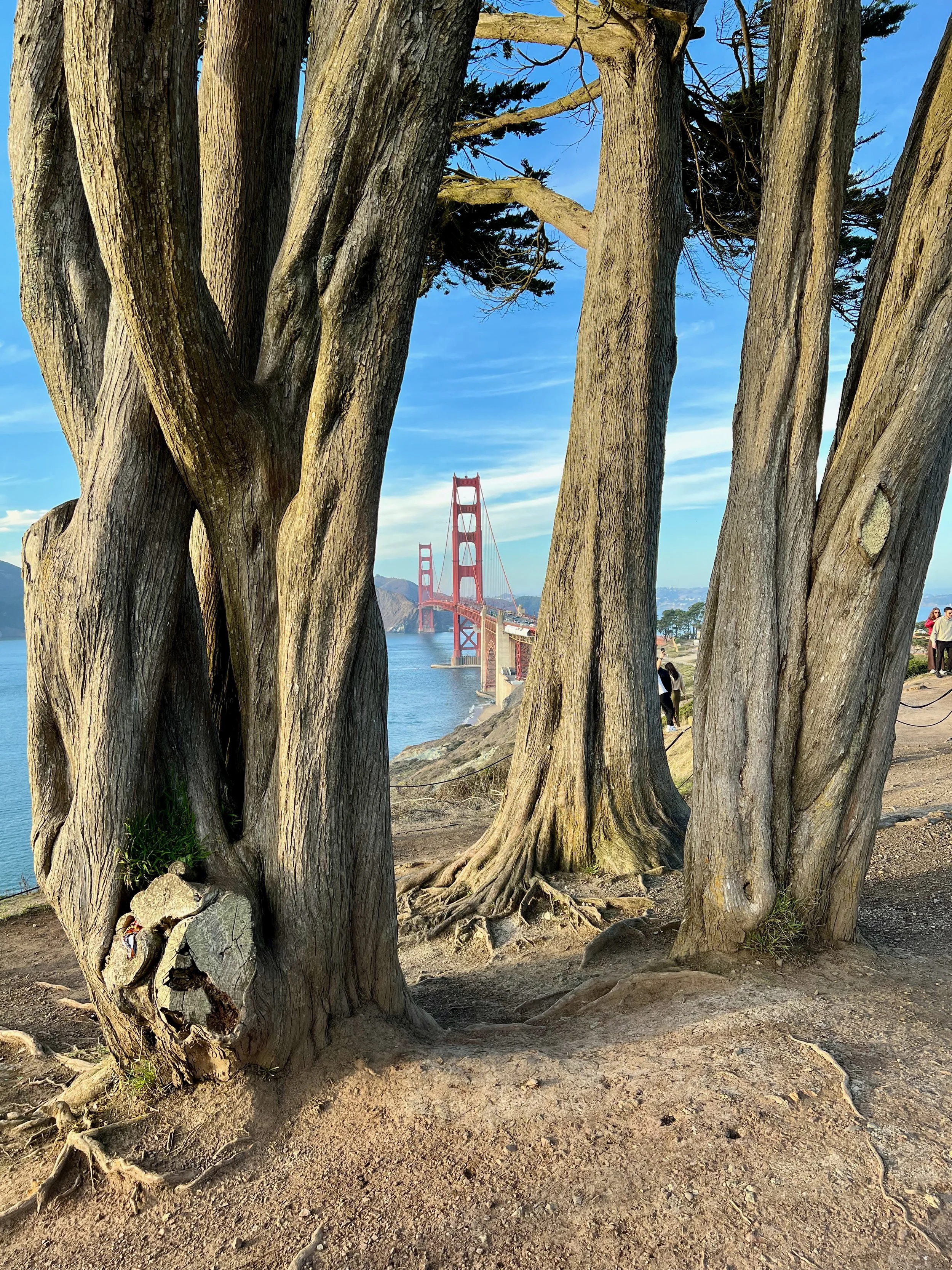
Getting closer to the Golden Gate Bridge: Great views through the Monterey Cypress trees.
Know Before You Go
Trail Facts
- The combined Lands End and Batteries to Bluffs Trails cover about 4.5 miles and take around 2 hours — but you can easily spend half a day or even an entire day exploring tide pools, taking photos, and relaxing at the beaches.
- For tide pooling tips, check out my article on Micro-Backpacking at Point Reyes.
- Use AllTrails to help navigate the route.
- Hike in the direction described in this guide — that way, the stunning views are right in front of you, not behind!
Best Time to Go
- Spring and Fall: Best seasons to hit the trails — with spring being my favorite time! Clear skies, calmer winds, and fewer foggy days. Spring brings lush greenery and wildflowers. September and October are actually the warmest months.
- Winter: On non-rainy days, it’s a great time to visit — trails at Lands End may be muddy, but, typically, there's no fog and just a calm breeze.
- Summer: Feels usually chilly, foggy, and very windy — not ideal unless SF is hit by a rare heatwave.
- Low Tide: If the tide is very low, you can walk from China Beach to Baker Beach and explore more of Marshall’s Beach. Plus, you might spot marine critters such as mussels and sea anemones. Check the tide chart here.
Safety & Regulations
- Ocean Safety: The Pacific along San Francisco’s coast is very cold, with strong currents and large waves — it's not safe for swimming, and you should never turn your back to the ocean.
- Dogs: Allowed on the Lands End Trail, but not permitted on the Batteries to Bluffs Trail.
Looking For More Great Things To Do In San Francisco?

Or, check out the experiences below to find unique tours and activities! If you find something you like and book through these links, I may earn a small commission — at no extra cost to you. It's a great way to support this blog while planning your adventure.

Follow the Adventure
Latest on the Blog
Search
📌 Pin for later