What a Superbloom Really Looks Like: Our Visit to Carrizo Plain National Monument
The Carrizo Plain National Monument is a remote place in the heart of California's Central Valley that comes to life with wildflowers during spring, occasionally showcasing a superbloom in ideal years — as it was the case in 2023. The monument is a vast grassland that historically stretched across much of California’s Central Valley. Today, it is, in the midst of agriculture and the oil industry, the last remnant of this type of landscape in California.
Oil and Blossoms: Gateway to the Wildflowers
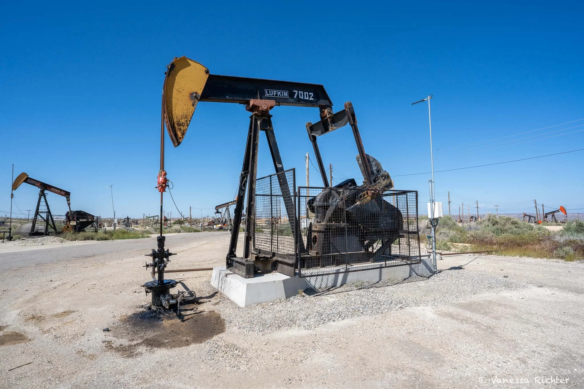
The night before our adventure, we pulled into Taft, a small town perched in the foothills at the southwestern edge of the San Joaquin Valley: one of the closest gateways to Carrizo Plain. Sounds romantic, doesn’t it? But the reality is more complicated. Taft lies in Kern County: one of the most polluted places in California, if not the entire U.S. Bakersfield, Kern’s largest city, regularly tops the charts for particle pollution, thanks to its unlucky geography and the ever-present oil industry. I’d be lying if I said I didn’t feel uneasy spending the night there. But then I caught myself how ridiculous that thinking was. We were just passing through. People live here, breathe this air every day, and call this place home.
I know, this isn’t the uplifting start to a story about wildflowers you might have expected—but stick with me. Before marveling at the beauty of the super bloom, it’s worth taking in the bigger picture. It's humbling to see up close what it takes to extract oil for human use: how the industry reshapes the land and pollutes the air. Yet, it's also an educational and eye-opening experience to witness, and smell, firsthand how oil rises from the earth. A stark reminder of how closely beauty and destruction can be.
By morning, we were eager to hit the road. The drive from Taft over Fellows into the Carrizo Plain was an adventure in itself. One moment, we were surrounded by nodding oil pumps and the sulfurous scent of drilling. The next, those signs of industry faded into rolling hills and open sky, until finally, we entered a place that felt like true wilderness. Oddly enough, I found something mesmerizing about the slow, rhythmic motion of the pumpjacks. A strange kind of meditation. But as we left them behind, it felt as though they had never existed at all.
In a Nutshell: Cultural History
The Carrizo Plain National Monument in the heart of California is such a remarkable landscape: it is the largest single native grassland in the state of California and a vast expanse of historic significance and natural beauty.
The rich history dates back centuries. Native Americans, including the Chumash and Yokuts, called this land home and depended on the fertile soil and abundant wildlife for sustenance. Later, in the mid-1800s, European settlers arrived in the area and introduced farming and ranching. In the early 20th century, the discovery of oil deposits beneath the surface triggered a boom in the oil industry. Oil wells and towers lined the landscape, which is today still happening outside the National Monument, bringing prosperity but also significant environmental problems.
Fortunately, the Carrizo Plain National Monument was designated by President Bill Clinton under the Antiquities Act on January 12, 2001. This placed a significant portion of the Carrizo Plain under protection to preserve its unique natural and cultural resources.
Giant Lupines and Yellow Carpets
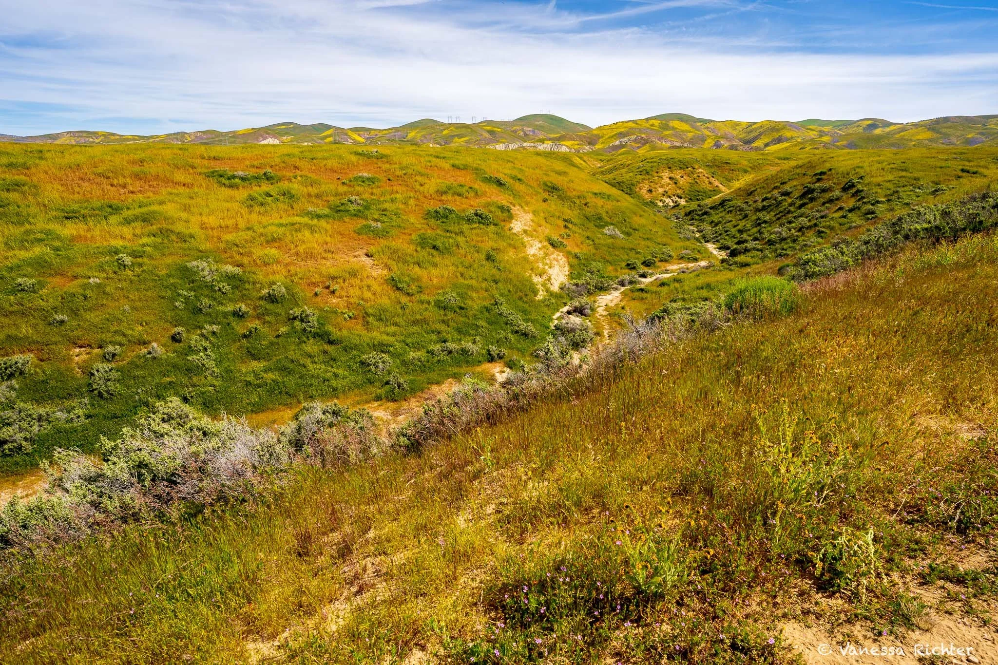
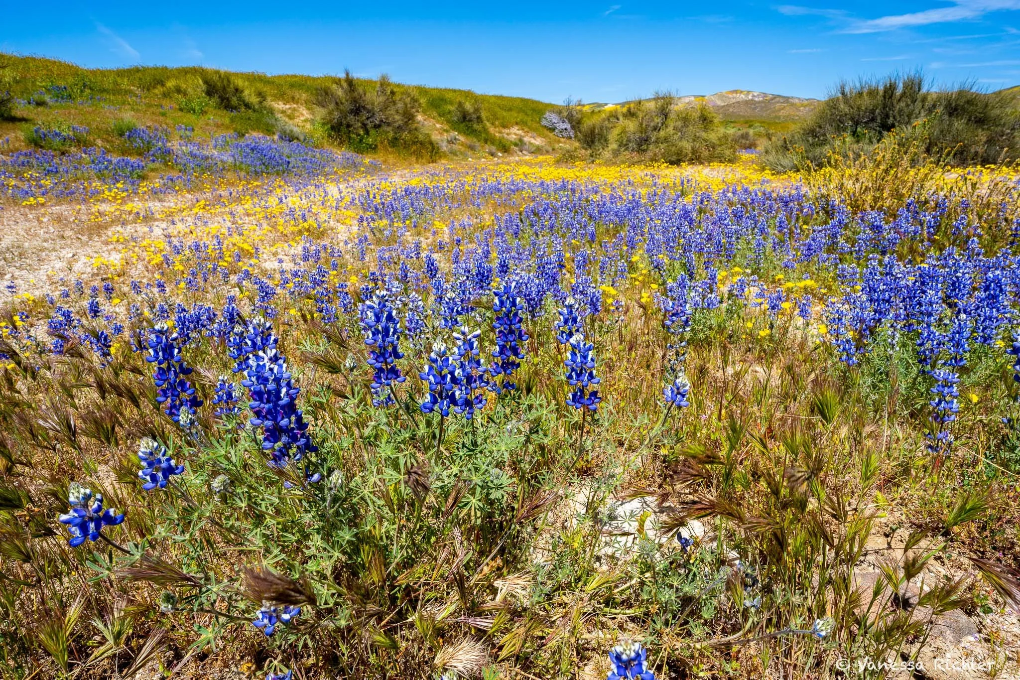
The drive led us through winding roads, where one could only wonder what would be behind the next curve. The gentle hills with some yellow and purple patches were a first taste of what would await behind them. At what appeared to be like an old homestead, we discovered some beautiful, giant and very healthy looking lupines, perfectly ‘arranged’ at the foot of gentle hills covered in lush grass and yellow flowers.

The colors guided us through this beautiful landscape. Soon after we entered the road meandering through the hillsides, we stopped fascinated by purple lupines and yellow flowers that dominated the landscape.
We delved deeper into the plain and while the wildflowers were the main reason for us to come here, there was something else we wanted to see up-close.
The San Andreas Fault
The geologic feature that many Californians fear. The fault was made famous by the great earthquake of 1906 that destroyed much of San Francisco. The earthquake was estimated at 7.9 on the Richter scale, yet the fault can produce earthquakes even stronger than 8.0.
There are many places in California where you can take a look at the fault yourself, one of which is located within Carrizo Plain National Monument. Seeing the fault line for the first time, one might feel unimpressed compared to the legitimate fears this inconspicuous geological feature can provoke.
We stretched our legs on the hiking trail along the fault line where one can also learn more about it, as the trail is equipped with information boards. Many small lizards crossed our path as we explored the trail along the fault line. The smaller wildflowers in this area of the plain were already mostly overshadowed by fiddle-necks at this time in late April, which stretched their heads far above most other wildflowers.
Let me present you: The San Andreas Fault
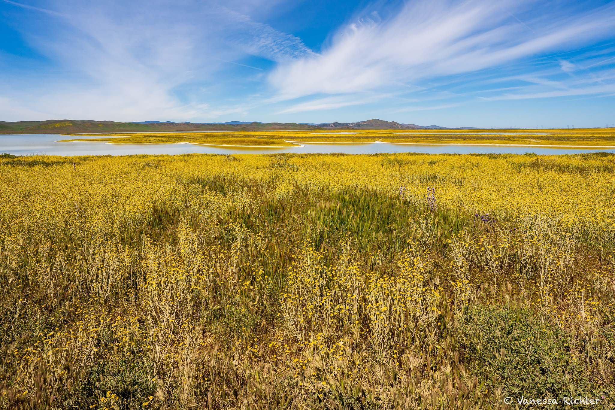
We continued driving towards Soda Lake. The cars swirled large clouds of sand through the air. The road was actually a pretty well-built gravel road that didn't have too many potholes or large rocks, yet extremely dusty. Our way was accompanied by incredibly large yellow-glowing flower fields interrupted picturesquely from time to time by purple lupines. From the distance, we could already see that the flower fields also spread out around the salty lake.

Soda Lake: Snow on the Beach?
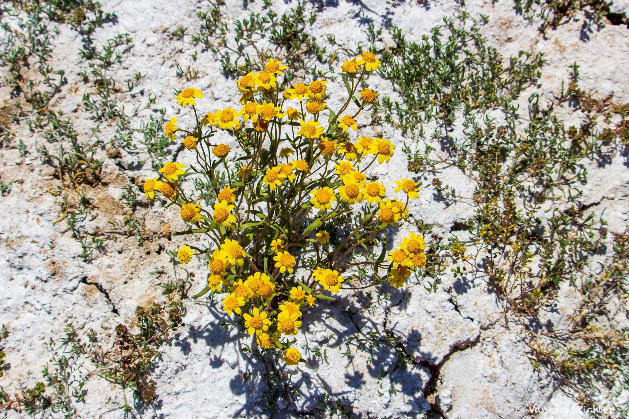
Soda Lake is usually dried up in summer, but was full of water on this spring day. It stands as the largest remaining natural alkali wetland in southern California, nestled uniquely within the coastal mountains as the only closed basin. True to its name, this natural wonder undergoes a process where salts are concentrated as water evaporates, resulting in striking white deposits of sulfates and carbonates.
The area around the lake was busy, but it was still possible to find quieter spots. The lake is so salty that it seemed as if the beach was covered in snow. Even more fascinating is that many flowers sprout from the salty sand. A very surreal scenery. We found a great spot near the lake where we just sat for a while and enjoyed the spectacle.
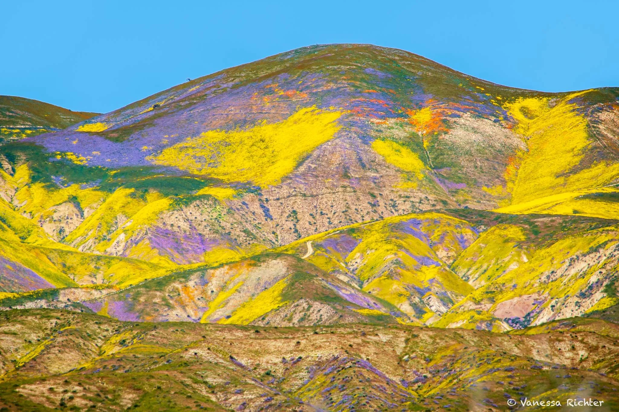
When Nature Paints Its Own Masterpiece
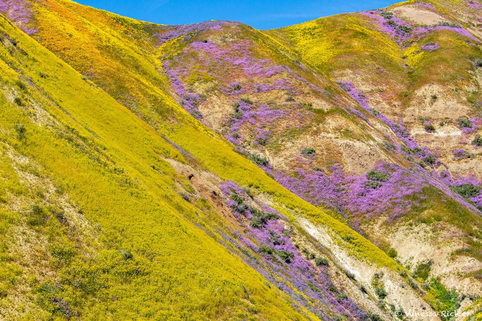
After that, we let ourselves be guided by what we saw from afar: The colorful slopes that looked like someone had painted a picture of an imaginary landscape. Shades of yellow, purple, orange and green blended together perfectly. A road led directly toward these hills, letting us get closer and closer to them.
When we got to the hills, we decided to take a chance and drive up one of the rugged roads into them. I had read that some people got stuck there when the roads were wet, but now the weather was perfectly sunny and the ground was as dry as can be. Still, the drive was an adventure. The road was very uneven and had large holes in places, combined with steep inclines that were a challenge for the car. The risk was worth it, however, because we were able to admire the colorful slopes up close while seeing hardly any other people.
We crossed the hills, hoping that the roads wouldn’t get any worse. They didn’t and so we were able to leave this magical place on the other side of the hills, leading us back to the very different scenery of the ever-nodding oil rigs.
Know Before You Go
Best Time to Visit
First things first: Superblooms are rare! So what you see in my photos happens only every few years, when all the right conditions come together. But: even a regular or below-average bloom can still be beautiful.
The wildflower bloom occurs only in spring, typically between March and April, though the exact timing varies each year. The same goes for the number of flowers that appear.
Related to the former point: The landscape is constantly changing in spring when some places are in full bloom while at others the flowers are just starting off or already fading, depending on the species and the orientation of the hills towards the sun.
While we were certainly not the only people visiting, and some very popular places like the area around Soda Lake got even pretty crowded, I felt like this still rather is one of the more hidden treasures. Which may also be because of the remoteness of this location.
Road Conditions
The roads inside the monument are dirt roads. Most of them are doable with most vehicles. If you really want to explore the hillsides and feel comfortable driving real rugged roads, you will be better off with AWD and a high clearance, which is crucial if you want to minimize the risk of damaging the underbody of the vehicle.
When the soil is wet, it is advisable to stay off these rugged hillside roads in general. The risk of getting stuck in the mud is high in such conditions.
More Wildflower Adventures in Spring You Might Be Interested In


Latest Articles
Looking For Something Else?